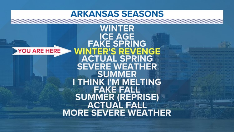
LITTLE ROCK, Ark. — Many Arkansans have taken delight in the "fake spring" pattern we've seen over the past few weeks.
Unfortunately, good things cannot last forever, and another round of wintry precipitation is becoming increasingly likely for portions of the state. The National Weather Service in North Little Rock has issued a Winter Storm Warning and Winter Weather Advisory for northwest and north central Arkansas.
This warning area does not include the Little Rock metro.

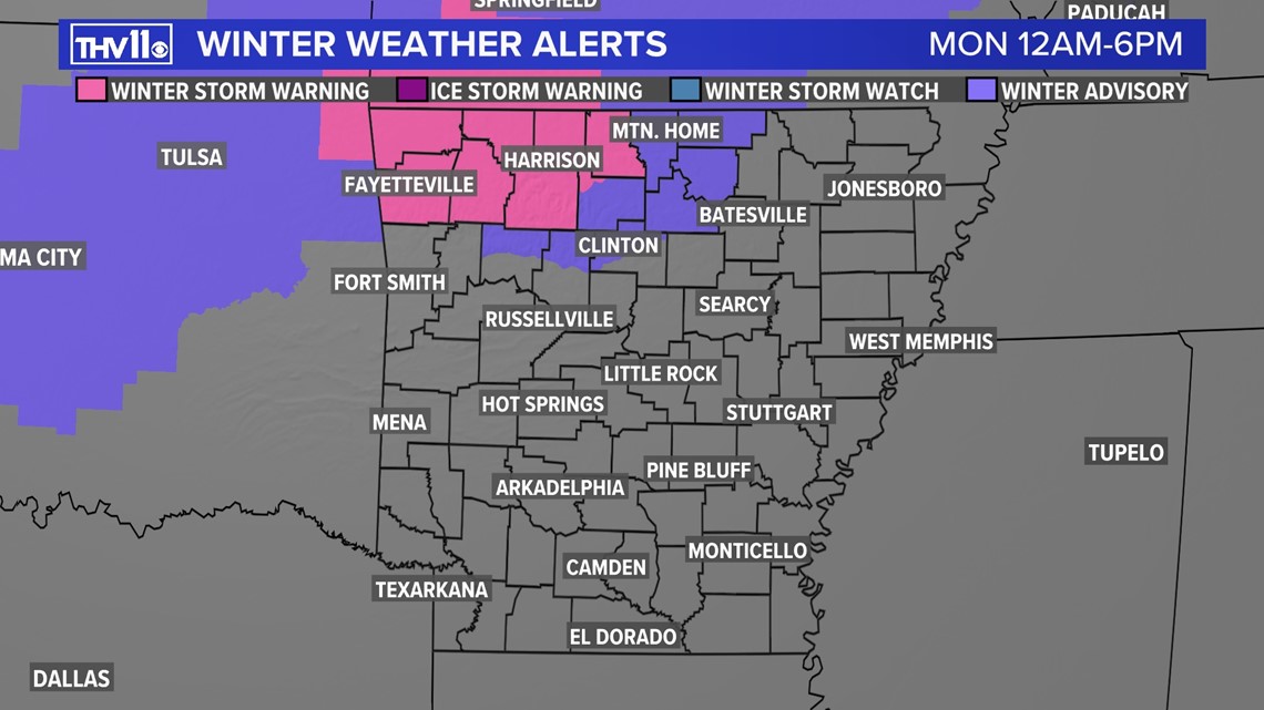
Although central Arkansas is not expecting winter weather, another round of rain and cooler temperatures will help start the work week.

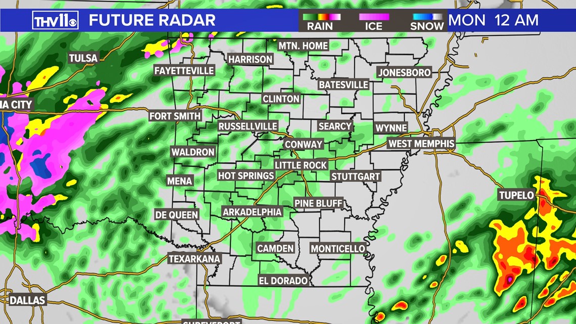
Starting Sunday night, rain showers will move in from the west. By midnight, rain will predominantly spread across central and western Arkansas.

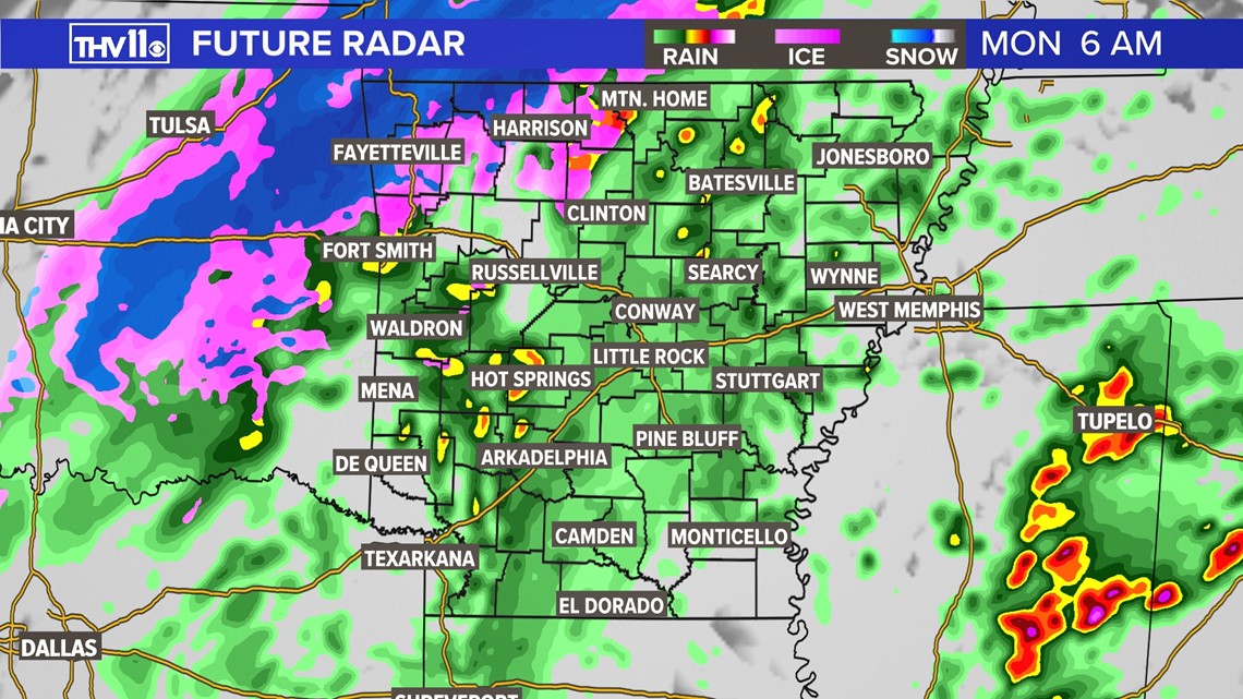
By the Monday morning rush hour, rain will transition to snow/ice across northwestern Arkansas. Central Arkansas will continue to see only rain.

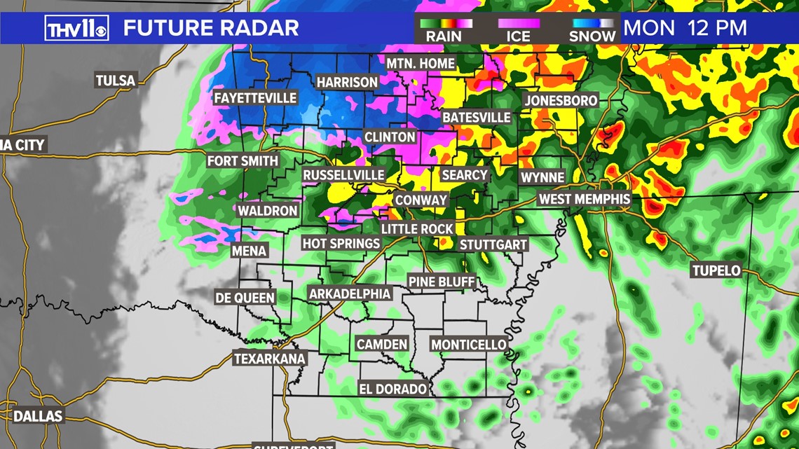
Rain will transition to snow/ice by lunchtime across north-central Arkansas. Winter precipitation continues across northwestern Arkansas. Light to moderate rain showers will continue across the rest of the state.

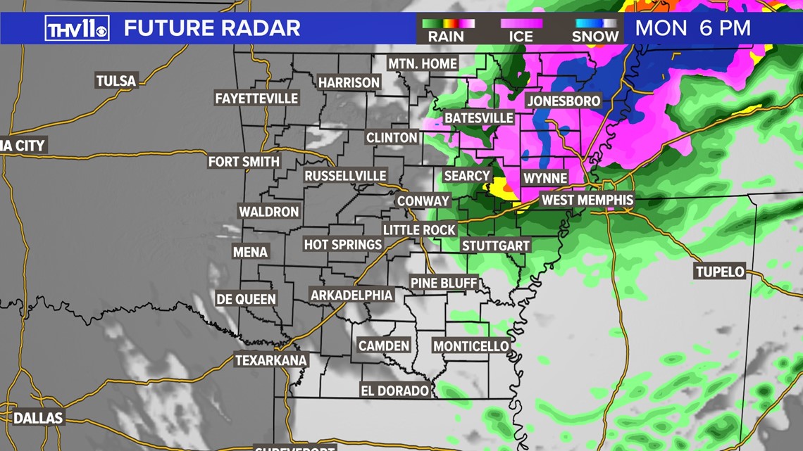
By the Monday evening rush hour, precipitation will start clearing from west to east. The threat of wintry precipitation will still be likely across northeast Arkansas.

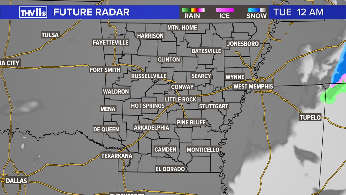
By Monday night/midnight Tuesday, all clouds and precipitation will be well to our east.

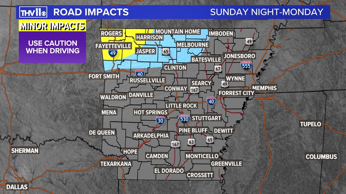
The snow and ice will create minor travel impacts across northwest and north-central Arkansas. Anyone traveling northbound along HWY 65 (towards Clinton) or westbound along I-40 (towards Russellville and Fort Smith) should use caution.

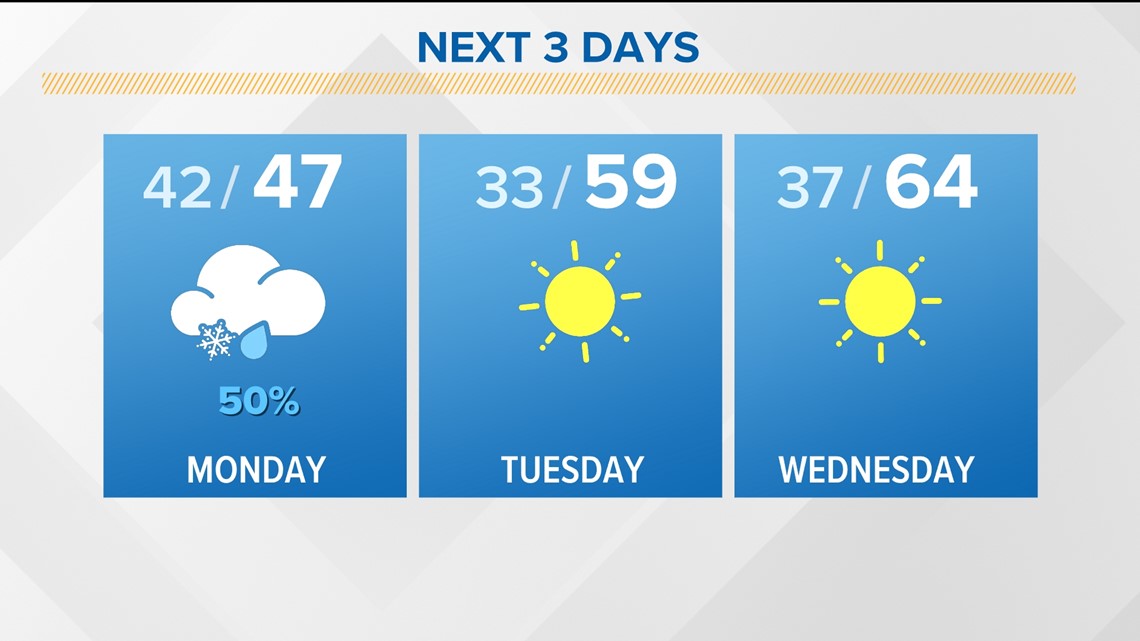
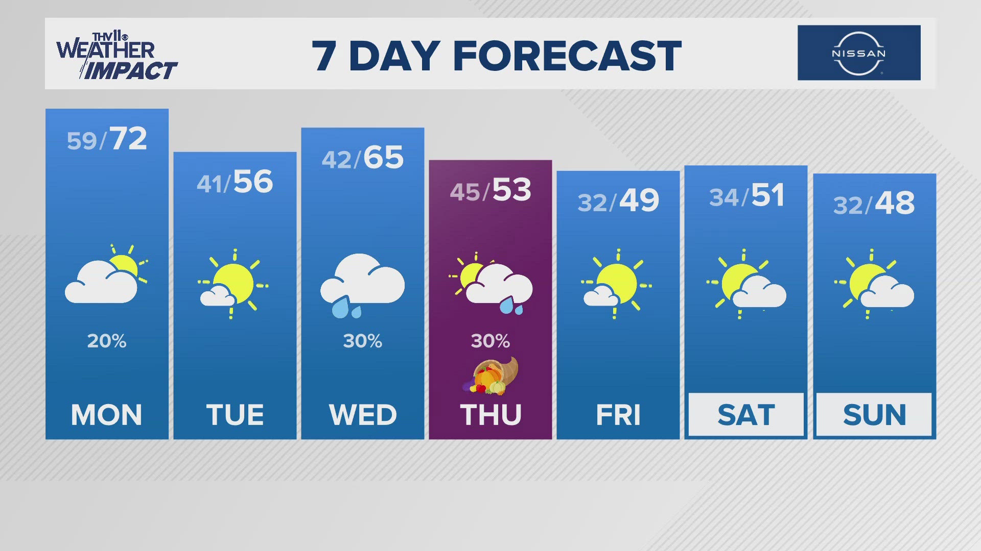
Due to the clear skies, Arkansans will see a cold start to Tuesday, but warmer temperatures will come by afternoon. This sunny, spring-like pattern will stick around for the next few days.


