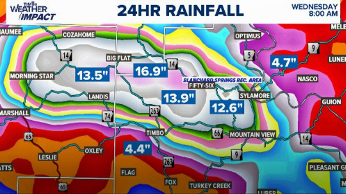
LITTLE ROCK, Ark. — After heavy rain entered the Natural State overnight and into the morning, parts of central and north Arkansas have reported experiencing flooding this morning.
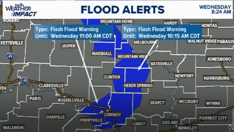
The National Weather Service in Little Rock placed southern Baxter County, southern Marion County, northeastern Searcy County, and northwestern Stone County under flash flood warnings until noon.
Due to this, the THV11 Weather Impact Team has issued a Weather Impact Alert that will be in effect on Wednesday until 11 a.m.
According to the Faulkner County Sheriff's Office, 419 homes in the area are currently without power. Areas severely impacted in the county include:
- Saltillo Road from Rocky Point to Gerob
- Lower Ridge Road from Hwy 64 to Valle
- Pickles Gap Rd at the Low Water Bridge
- Castleberry Rd. near Burkett Flat Rd
The City of Conway issued a notice that the downtown area is experiencing some localized flooding, along with College Ave at Tucker Creek, S. German Lane, and many other areas throughout town.
Officials advised drivers to use caution and avoid areas with high water when traveling. City departments are currently working together to block off access to the flooded areas.
Additionally, a flash flood warning has been issued in Morrilton. The city's police department warned that multiple roadways are flooded and have already received calls of vehicles stuck in floodwaters.
Some other locations that the NWS stated may experience flash flooding include:
- Advance
- Allison
- Blanchard Springs Campground
- Cartney
- Cotter
- Duff
- Big Flat
- Flippin
- Gassville
- Gilbert
- Lion Hill
- Marshall
- Maumee
- Pyatt
- Rush
- Shipp
- Summit
- Thola
- Mountain View
- Yellville