LITTLE ROCK, Ark — Expect a wet start to the weekend for central Arkansas as a strong cold front will sweep through the state on Saturday.
In advance of this boundary, a warm and humid airmass with some wind energy will occur. With these ingredients in place a few storms could become strong to severe. However, the threat is relatively low, and the highest risk is for areas South and East of Little Rock since the atmosphere will likely be more unstable as the front arrives later in the day.
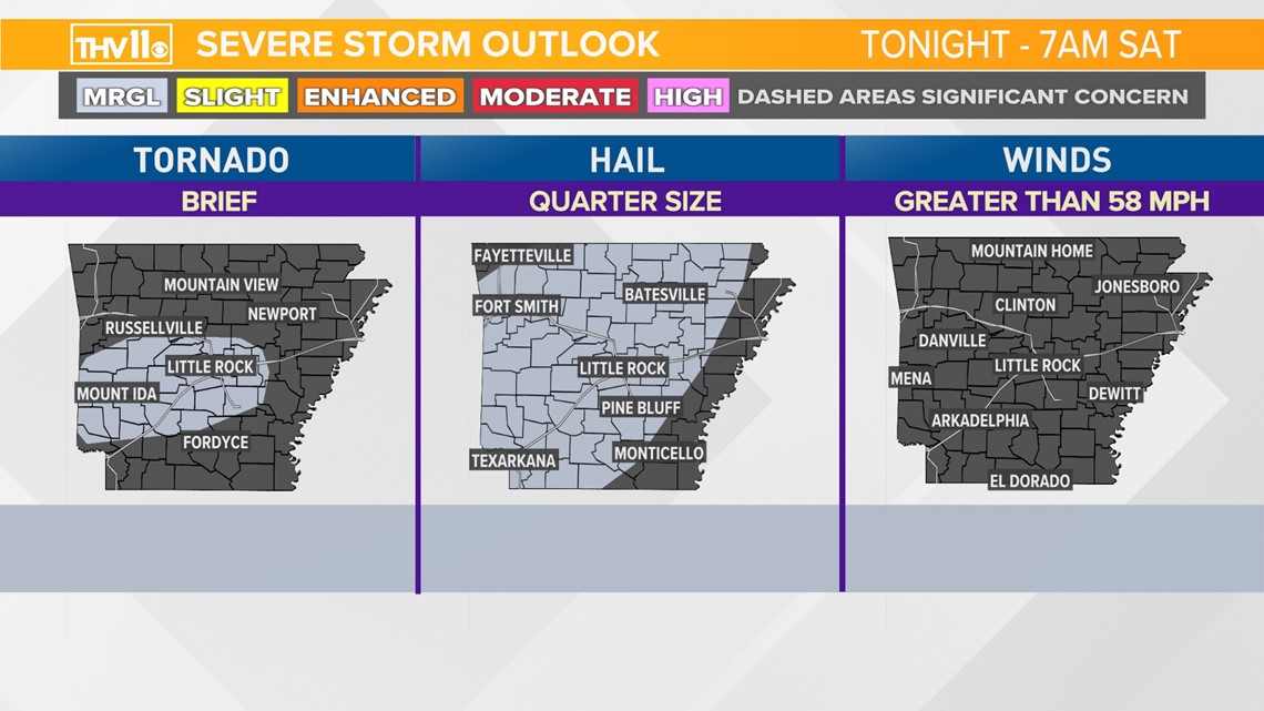
The latest update from the Storm Prediction Center shows the chance of isolated strong to severe storms developing Friday night and early Saturday morning for Little Rock and the west. Any storm could produce a lot of lightning, large hail and a quick tornado.

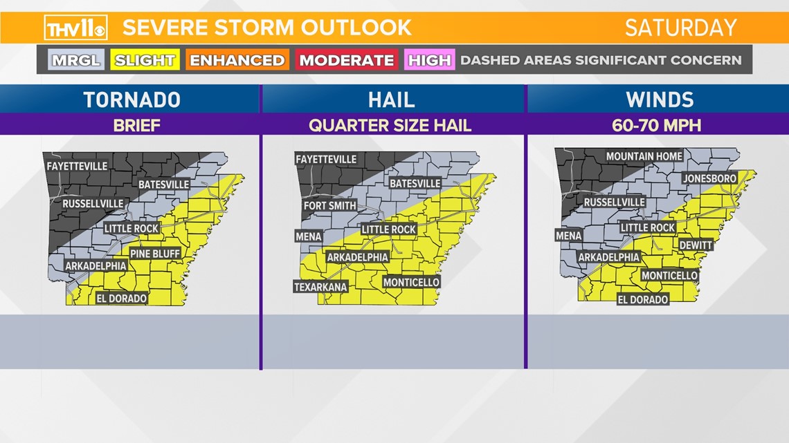
The chance of severe weather increases slightly later Saturday morning and through the day as the front pushes East and Southeast. This area highlights east of Interstate 30 and south of Interstate 40 with the best potential that cells could produce large hail and damaging winds, which are the main threats from this event. The threat of a quick tornado embedded in a line of storms can’t be ruled out, but the chance is low.

TIMING BREAKDOWN:

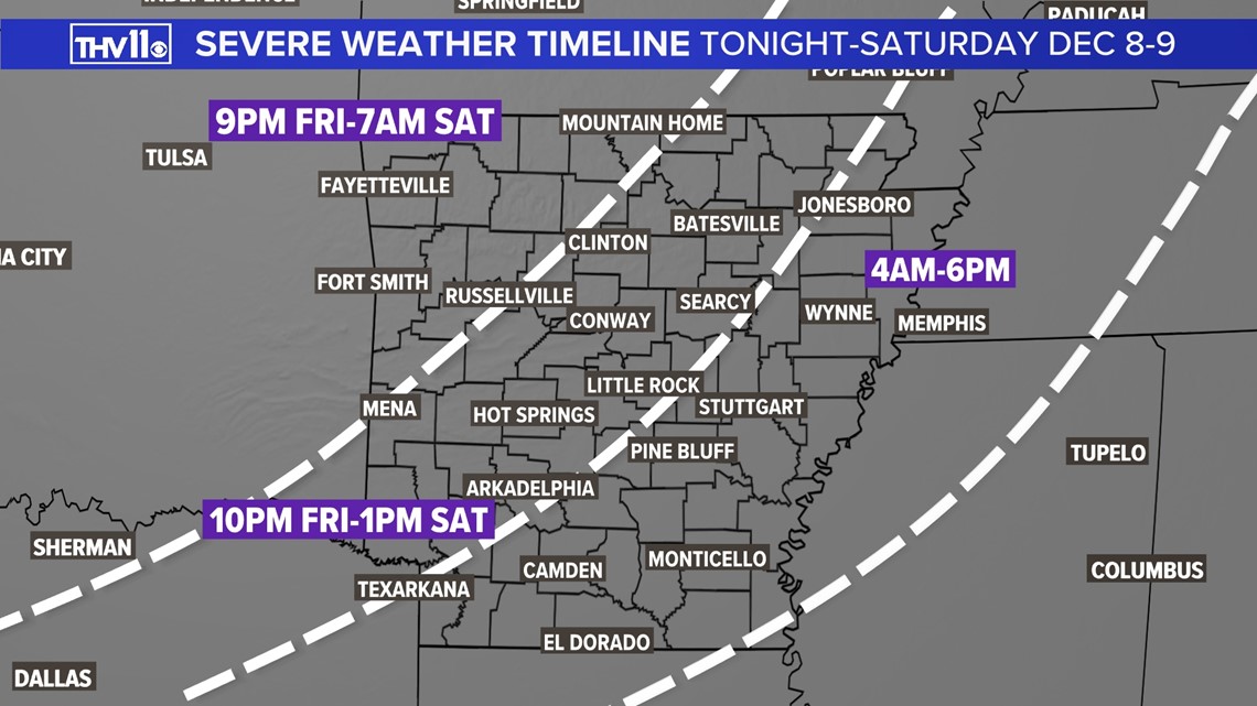
On Friday night, as early as 10:00 p.m., spotty storms may develop as warm and humid air floods into the state from the South. Any storm that can tap into the unstable environment may produce pea to quarter size hail and gusty winds. One or two storms could produce hail slightly larger than quarters. The Storm Prediction Center has added a slim chance of a quick tornado. This is due to enough wind energy that may allow the strongest cell to rotate.
Saturday, the front will continue to march east and southeast, taking the threat of severe weather into SE and E Arkansas through the afternoon and early evening. Most areas from Little Rock and north and west should be done with the severe weather threat in the early afternoon, possibly earlier.
However, locations south and east of the Little Rock metro need to stay weather-aware through the afternoon and evening. Any developing storms may produce heavy rain locally and the chance of hail, high winds and/or a quick tornado.
All of Arkansas will likely be done with the threat of severe weather by 7:00 p.m. Saturday.
After the front swings through your neighborhood, the winds will pick up from the NNW 10-20 mph with 30 mph gusts. These winds will bring in much colder temperatures Saturday night into Sunday.
Gusty winds and chilly temperatures will make it feel like winter once again in Arkansas when you wake up on Sunday.

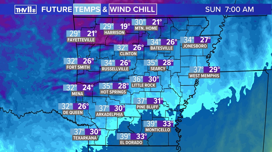
Highs on Sunday, even with mostly sunny to partly cloudy conditions, will climb into the 40s.
Make sure you download the THV11 app and stay tuned to THV11 for the latest weather updates!


