![NOAATornadoTrack [ID=8610989]](http://moc-assets-prod.gannett-cdn.com/-mm-/25b0f32bbf388f523e4fcf57de51132befc68e23/r=500x328/local/-/media/KTHV/KTHV/2014/05/02/1399048705000-NOAATornadoTrack.jpg)
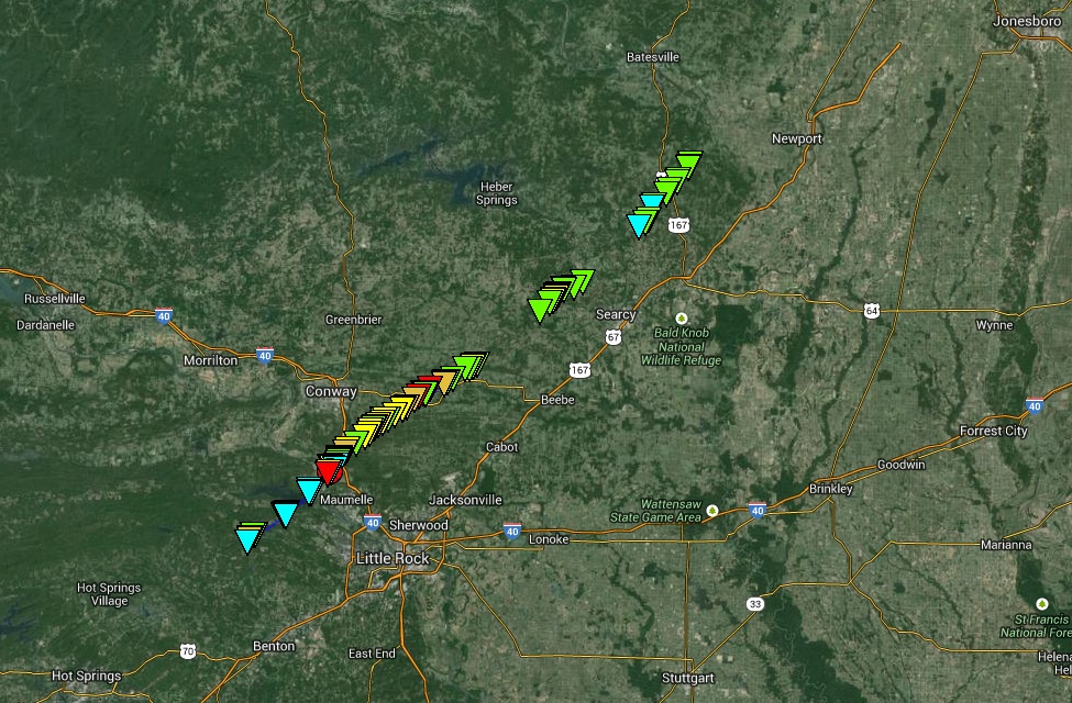
LITTLE ROCK, Ark. (KTHV) - The National Weather Service of Little Rock has released an interactive map of the tornado track that swept through central Arkansas on Sunday, April 27, 2104.
The map shows the tornado, which was later determined to be a high-level EF-4, first touched down on Heinze Cove in western Pulaski County then traveled in a northeastern pattern, and ended north of Union Hill Road in Independence County.
You can get more information on the places that the tornado touched down by clicking on the triangles on the map below.
(If the map below doesn't load, you can view it here: http://on.kthv.com/1nbambg)
![NOAA Tornado Map [ID=8610301]](/Portals/_default/Skins/PrestoLegacy/CommonCss/images/embed.jpg)


