
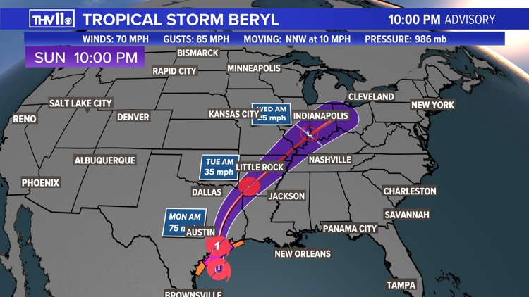
LITTLE ROCK, Ark. — The latest update from the National Hurricane Center is that Arkansas is in Tropical Storm Beryl's forecast cone.
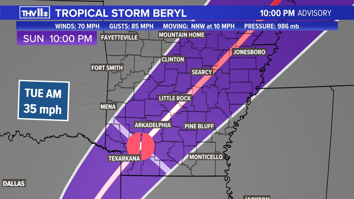
Beryl is expected to approach the Natural State early on Tuesday morning as a tropical depression. It will exit the state as a remnant low by early Wednesday.

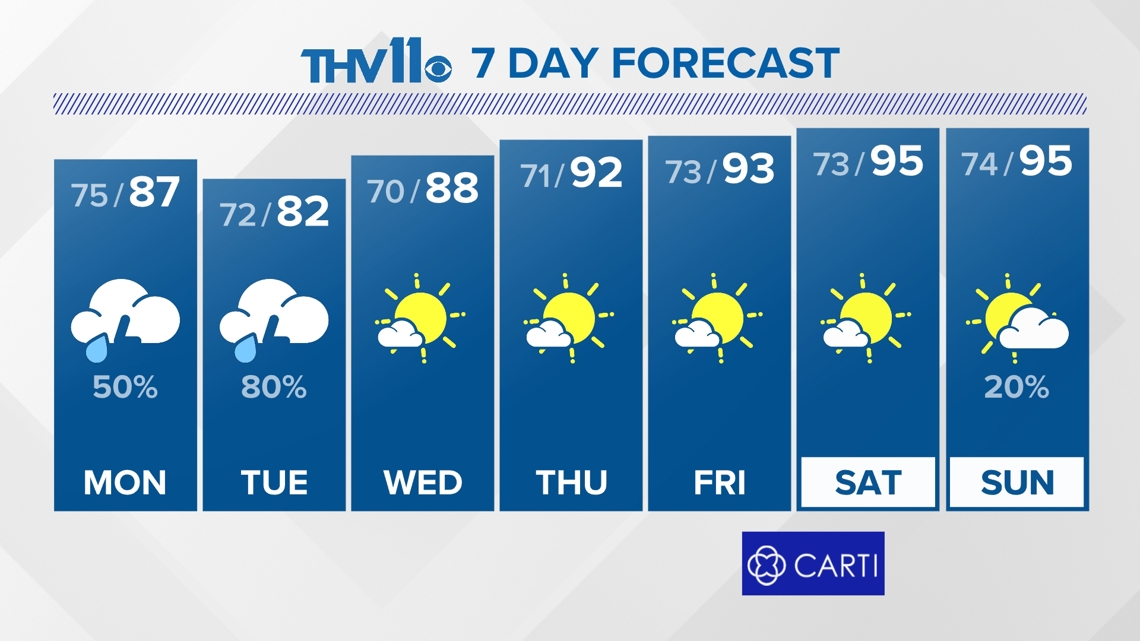
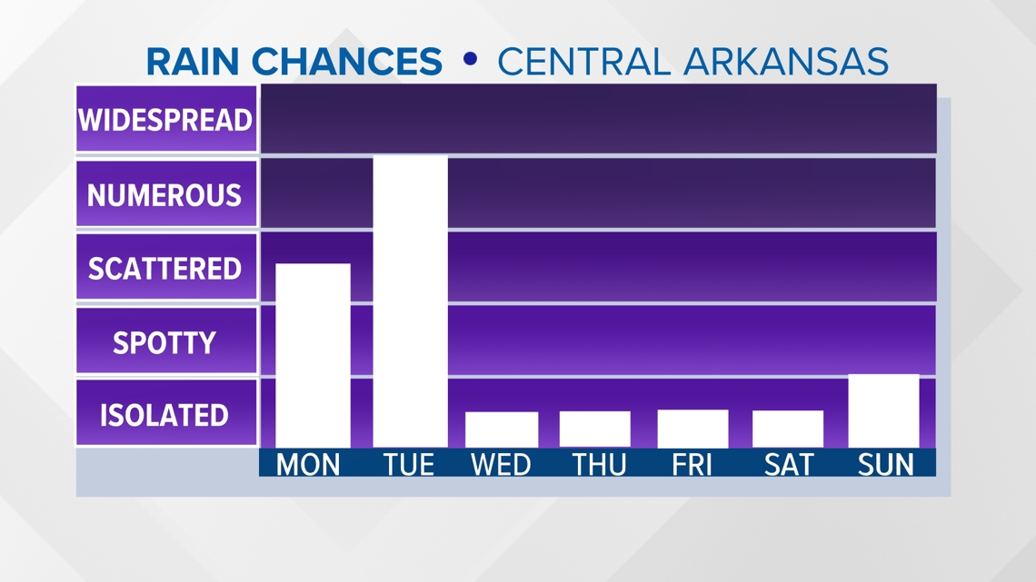
As Beryl makes the trip through our state, scattered to widespread showers and thunderstorms will likely cross central Arkansas. Rain chances will increase as early as Monday ahead of Beryl's arrival.

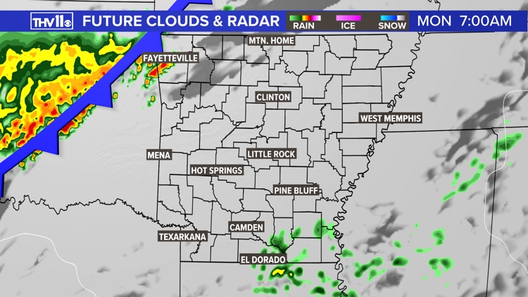
By Monday morning, a weak cold front will be off to our west in Oklahoma, and Tropical Storm Beryl will be off to our southwest in Texas. Ahead of both of these features will be increasing humidity and spotty rain.
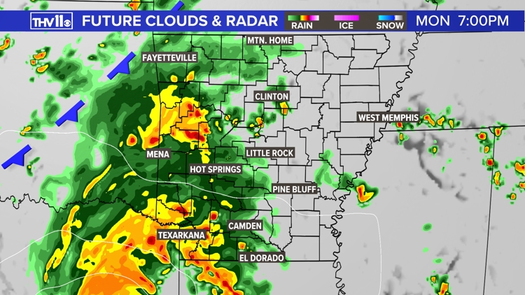
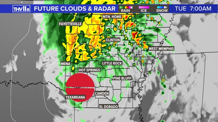
As Beryl draws closer on Monday evening, the front will dissipate. Rain coverage will continue to develop across the state's western half. Tuesday will be the standout day for widespread rain coverage across the state, as Beryl (now a tropical depression) moves north-northeast through the state.
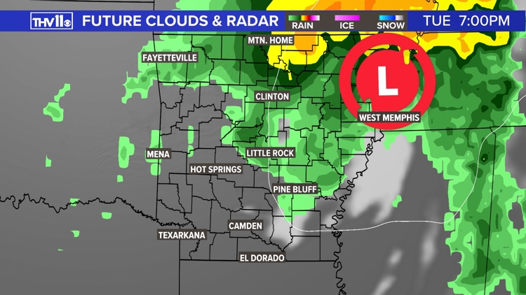
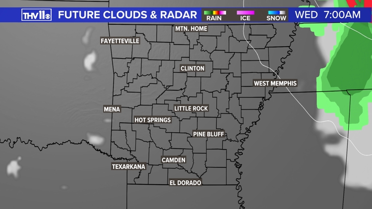
By Wednesday morning, Beryl exits the state as a remnant low. Behind its departure, quieter conditions are expected across Arkansas.
Projected clouds and radar


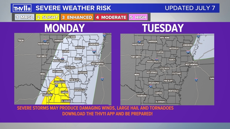
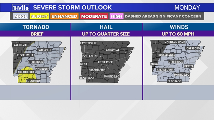
Strong to severe storms are possible during this timeframe, but Monday night/early Tuesday morning hold the greatest potential.
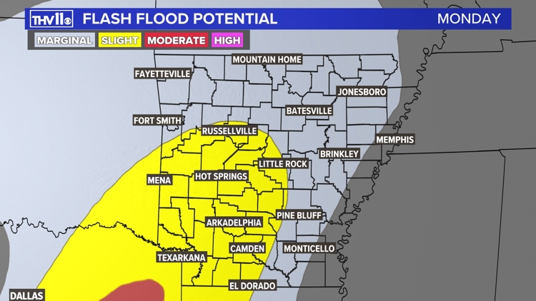
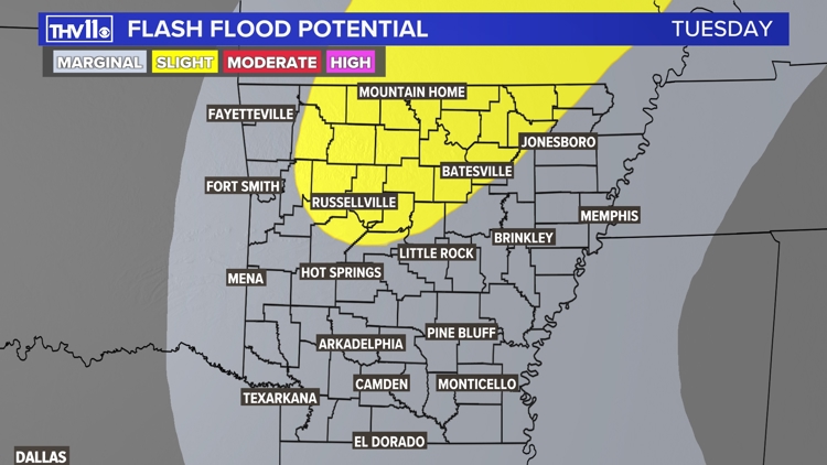
Damaging winds, heavy rainfall leading to flash flooding, and an isolated tornado cannot be ruled out.
Severe risk during Beryl's track through Arkansas


Monday and Tuesday flash flood potential


Sunshine and 90+ degree temperatures will return by the second half of the week as the upper-level "heat dome" settles in again.