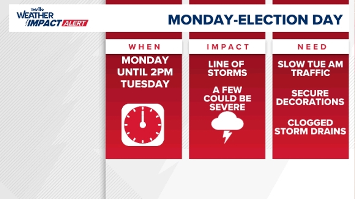
LITTLE ROCK, Ark. — A THV11 Weather Impact Alert has been issued for Monday through 2:00 p.m. on Election Day (Tuesday). Heavy rain and the possibility of strong to severe storms may impact your plans and travel.
When is stormy weather set to begin?
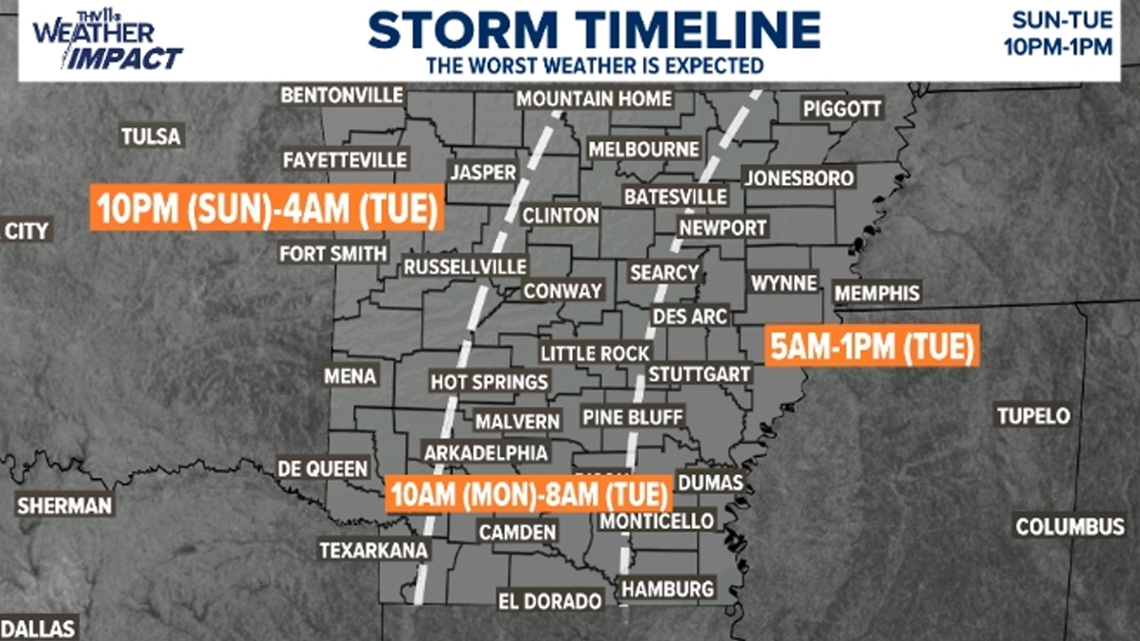
Showers and storms are expected to develop in west Arkansas on Sunday afternoon.
These storms are developing ahead of a cold front that will clear the region of severe weather by Tuesday afternoon.
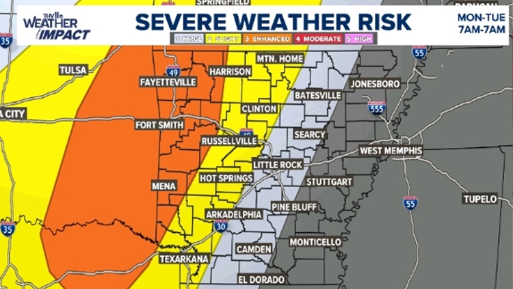
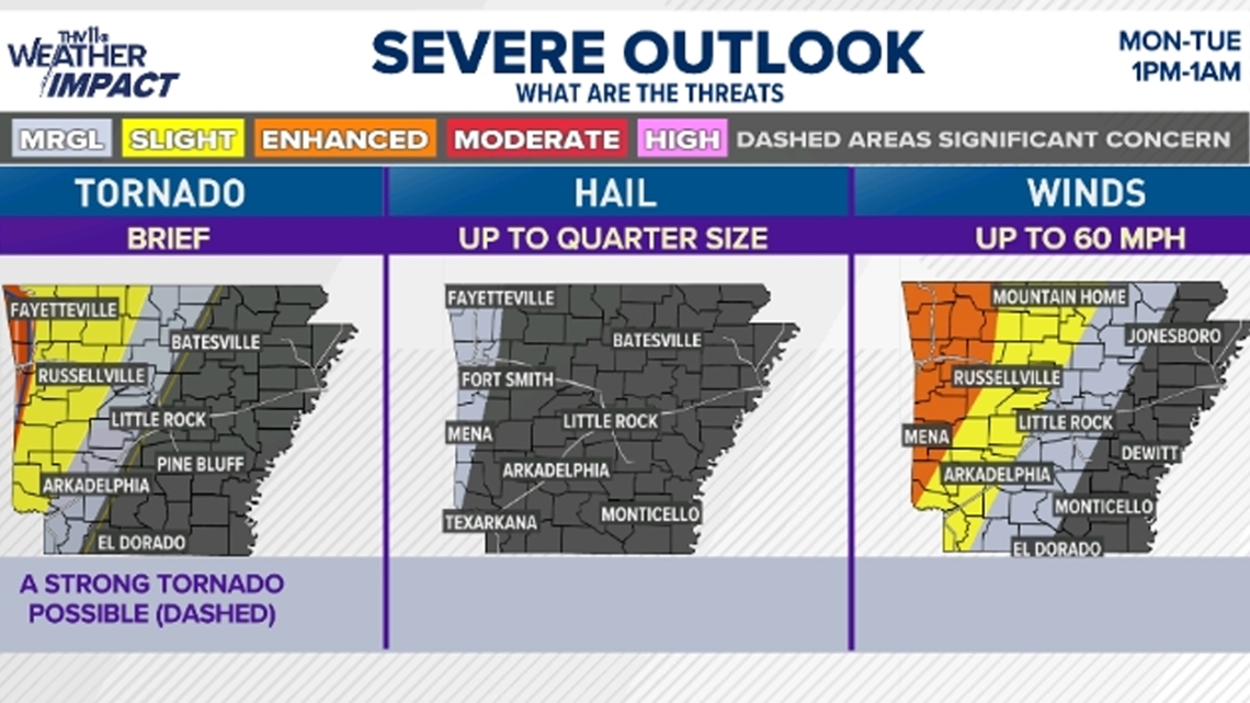
This is a slow-moving system, and the best chance of severe weather on Sunday into Monday morning will be in west Arkansas. Then the threat of severe weather will push into Central Arkansas by Monday afternoon and continue through Tuesday morning.


How will the weather impact me?
The main threat from storms that develop will be the potential of damaging 60 to 70-mph winds in the strongest cells. The hail threat is minimal, but a couple of storms may produce dime to quarter-sized hail.
There is some wind energy in place, but there's also a lack of instability or storm fuel. Therefore, the chance of a quick tornado is low at this time. There is more fuel and a higher threat of tornadoes in west and northwest Arkansas.
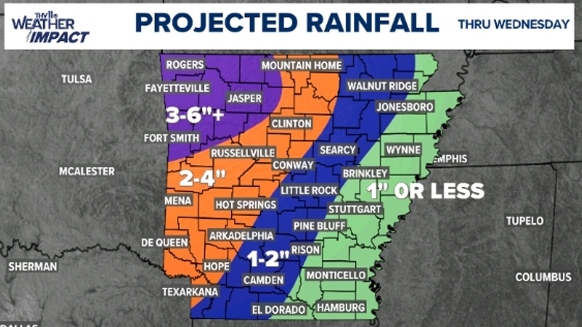
Another impact will be the risk of flooding as several inches of rainfall is expected over west and northwest Arkansas. The slow nature and ample supply of moisture will allow for the chance of heavy rain to fall over some locations for a long period of time.
Be sure and watch out for flash flooding of small creeks and streams, low-lying areas and poor drainage areas. Never drive through floodwaters especially if they are moving.
You don't know if the road is there and a small amount of water can carry a vehicle away. The highest risk of flash flooding is located in Ozarks and northwest Arkansas where a flood watch has been issued through Monday afternoon.


What do you need to do to be safe and prepared?
If you still need to vote you may want to plan to do that on Monday morning, because the chance of storms will increase on Monday afternoon and continue into the morning of Election Day.
You may want to prepare to give yourself extra time to get to work on Tuesday morning as it could be a slow commute if heavy rain is happening. Make sure your tires have a good tread to prevent hydroplaning and slow down watch for ponding on roads.
Also, some creeks and streams especially in west and northwest Arkansas could be spilling out of their banks.
Be sure to secure any decorations that could blow away if gusty winds sweep through your neighborhood.
Finally, with falling leaves, there is a high chance that some storm drains may become clogged. Park in areas to avoid any flooding concerns when possible. Low-lying areas will flood first since the water will drain in those spots.
Stay with the THV11 Weather Impact Team for the latest information and look for live updates on our streaming channel THV11+ throughout this fall and winter. THV11+ is available for free download on Amazon Firestick, Roku, and Apple TV.
Don't forget to join the THV11 Weather Watcher Facebook page and send your reports and videos of anything weather-related in Arkansas.


