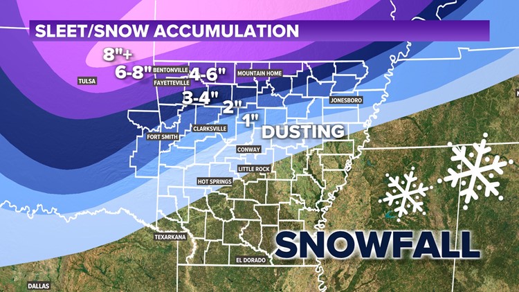
ARKANSAS, USA — February 2022 is starting off with a major winter storm to hit the central U.S., bringing a messy mix of rain, ice, sleet, and snow. The farther north you go, the more sleet and snow is expected. The farther south you go, the more ice is likely to buildup.
Arkansas and Oklahoma will get the heart of this storm, starting with ice and then switching over to sleet. Accumulations will be heavy.
WHAT'S NEW
- Storm pushing more south
- More snow northern AR, more ice central AR
QUICK FORECAST (scroll down for more)
- 0.1" to 0.5" ice possible -- heaviest in central AR
- Few inches of sleet/snow on top -- heaviest in NWA
WEATHER SETUP
Rain showers are moving north from the Gulf of Mexico. Colder air diving south from Canada will mix with the rain, changing precipitation to ice, sleet, and snow.

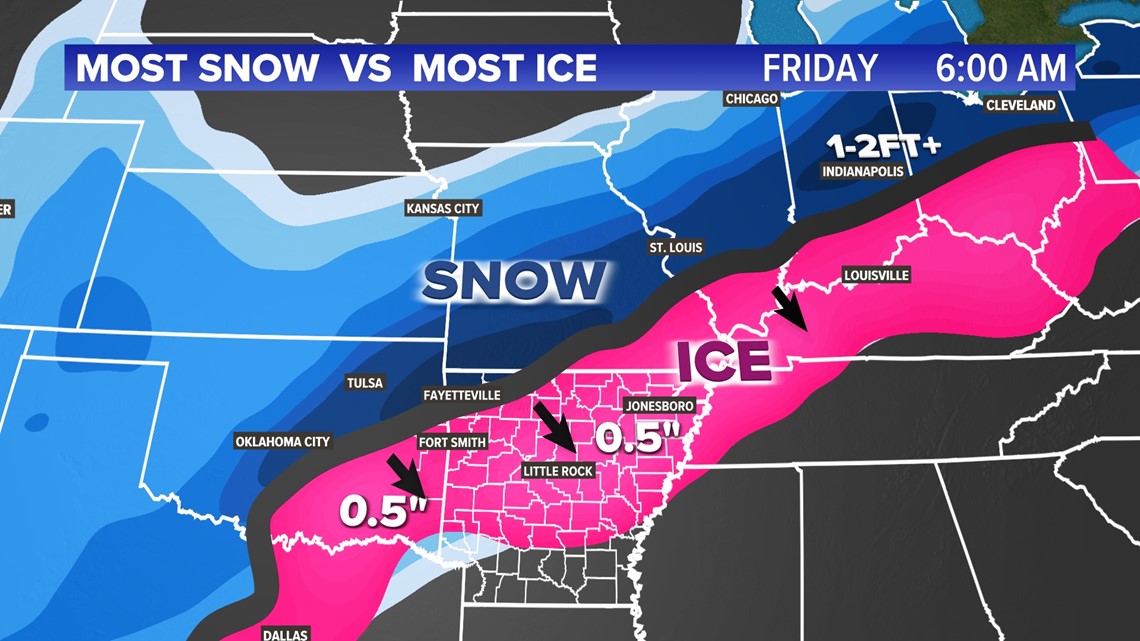
The heaviest snow will fall from Oklahoma into Missouri, Illinois, and Indiana. The biggest ice accumulations will build-up from Arkansas toward the Ohio River Valley. Northwest Arkansas and the River Valley are right on the edge of heavy snow and heavy ice. We'll get a mix of both.
ICE FORECAST
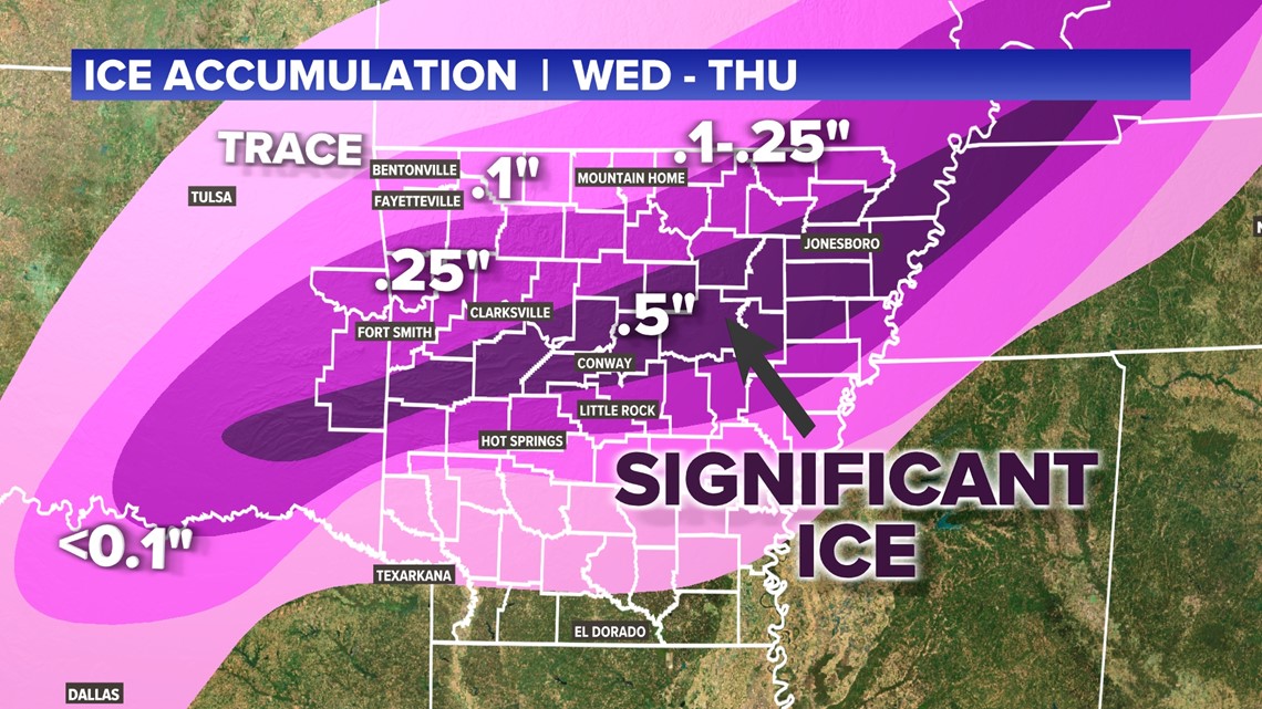
The biggest ice threats have pushed south to central Arkansas and SE Oklahoma. Less ice amounts toward the north are thanks to more snowfall taking over with colder air. Up to a half inch of ice is possible from Waldron to Conway and Jonesboro. The dark purple color indicates the highest ice threat.

WILL WE LOSE POWER?
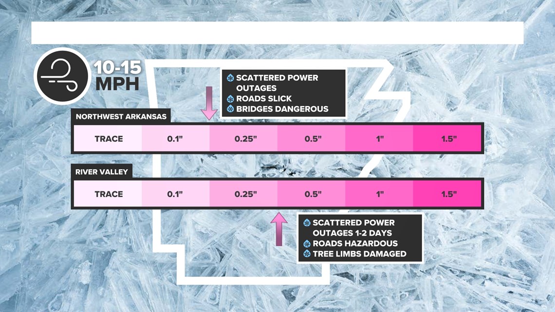
The more ice and wind you get, the higher chance for power outages. The highest power outages will be in the River Valley and central Arkansas.

SNOW ACCUMULATIONS
The bands of heavy snow continue to trend more south. Northern Arkansas may pick up 3-6 inches or more after rain and ice.
The amount of snow is likely to drastically differ from north to south.

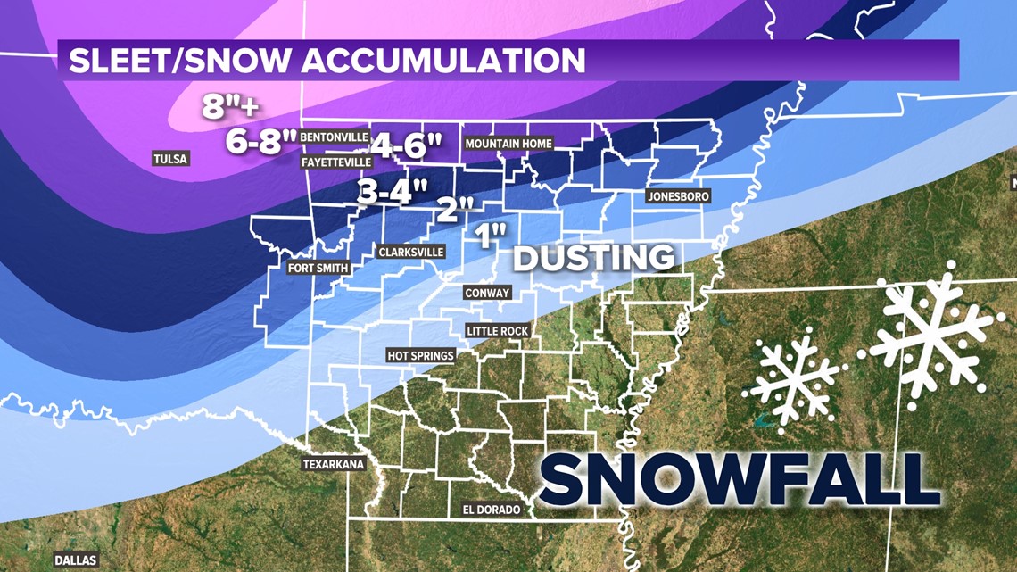
- Northwest Arkansas: 4-6"+
- River Valley: Up to 2"
- Central Arkansas: Up to a dusting
TIMING
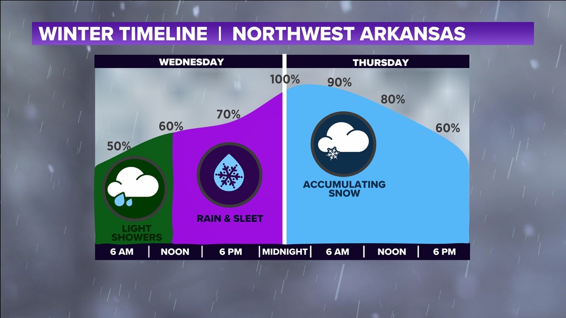
Northwest Arkansas will see ice by Wednesday early afternoon, and snow by early Thursday morning.

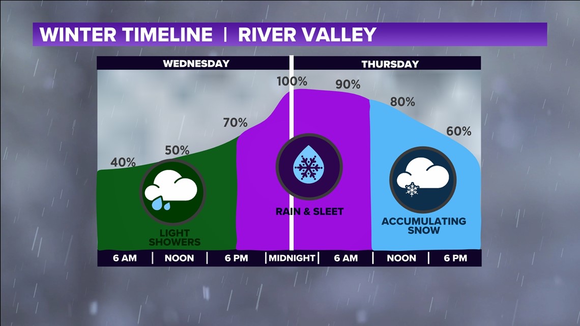
The River Valley will see ice by Wednesday night and snow later on Thursday

AFTER THE STORM
Wind chills are likely to drop below zero by Friday morning, but sunshine and 40s this weekend should begin to melt all of the wintry weather.
2021-2022 Winter Forecast
Forecast:

