LITTLE ROCK, Ark. — 5PM Update: Entergy confirms that more than 6,000 customers are without power, predominantly in the northern part of Arkansas, as the winter storm continues to pass through the state.
2PM Update: The north and south bound lanes of Highway 65 close temporarily around 1:50 p.m. due to the accumulation of snow, Searcy Sheriff Kenny Cassell says. Those lanes have since been reopened as of 2:25 p.m.
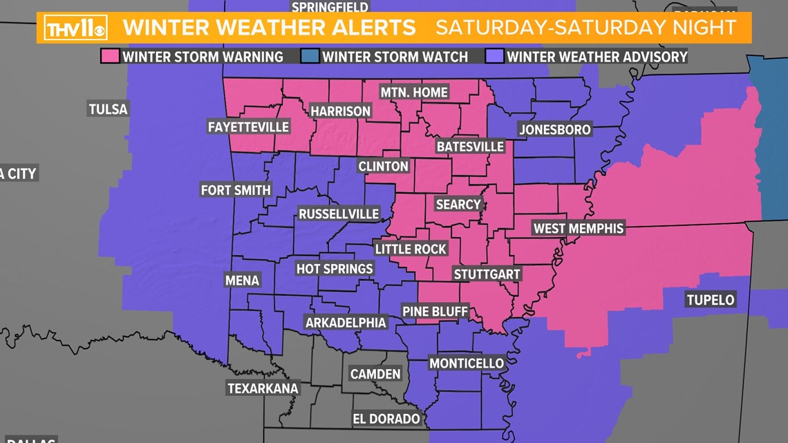
1PM Update: Central and eastern Arkansas have been upgraded to a winter storm warning through Sunday.


What to Expect:
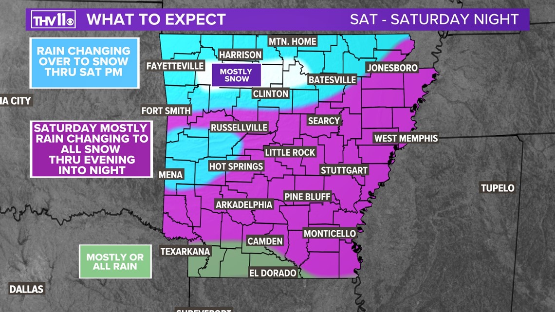
The scattered to numerous showers and areas of rain will pick up in coverage and intensity through the afternoon and evening.
However, cold air will bleed into north AR and the higher terrain of the Ozarks changing the rain to all snow as early as Saturday morning into the mountains above 1,500 feet. Primarily in Searcy, Newton and Madison counties.
The rain will transition to all snow through north AR going through Saturday afternoon and roads will likely become snow-covered and slick by Saturday evening.
In Central Arkansas we'll see mostly rain through the day until the late afternoon and evening hours. Then the subfreezing air just above the surface will punch into the region. Ground level temperatures will still be above freezing, but if the snow is heavy enough, it could begin to accumulate.
The best chance of accumulating snow in most of central AR, including the Little Rock metro, will be Saturday evening through early Sunday morning.
By sunrise Sunday, there could be a flurry or snow shower in east AR. The clouds will clear out through the afternoon and temperatures will warm into the mid to upper 30s.
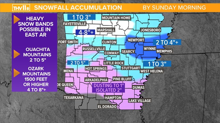
Snowfall Accumulations by Sunday Morning:


By far, the jackpot zone looks to be the higher elevations of the Ozarks. With three to seven inches likely, since they will see the cold air change the rain to snow first. It is not out of the question to see some spots end up with 10 inches of snow.
Roads will be covered and become slick in these areas, also power outages will be possible since this will be a heavy wet snow, weighing down trees and power lines.


The higher elevations of the Ouachitas could see a couple of inches.
In most of central Arkansas, including the Little Rock metro, a dusting to two inches is expected at this time. Roads may become slick late Saturday night into Sunday morning in some areas.
Stay tuned to THV11 Weather for the latest changes and updates on this potential winter storm.
Don’t forget to send you winter weather reports and pictures to the number below!


