
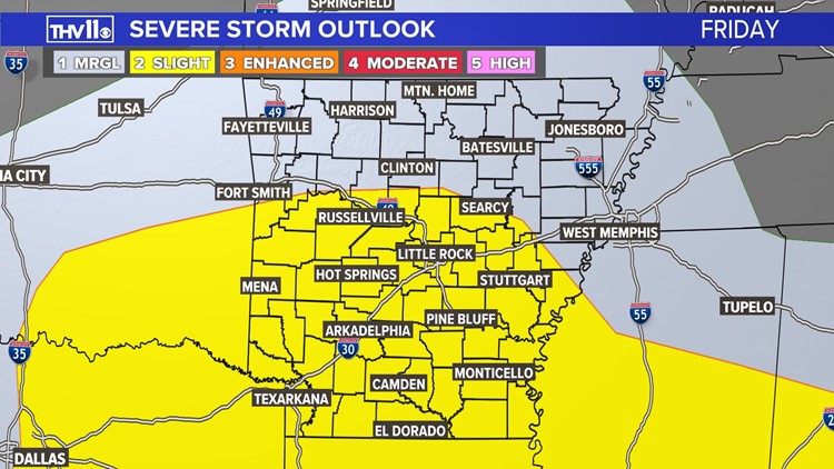
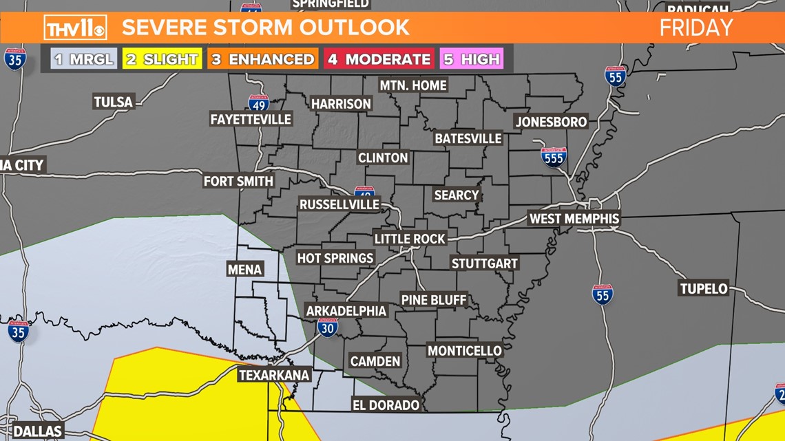
ARKANSAS, USA — A cold front will sweep through Arkansas today and tonight ushering much cooler temperatures especially during the night.
In advance of the front will be clusters of showers and storms moving through the state. However, the latest weather information by the Storm Prediction Center has significantly cut back on the chance of severe weather. The reason for this is the atmosphere will be stable not allowing for enough storm fuel in place to ignite severe storms for most of Arkansas. Also the low jet stream is confined in Louisiana and Mississippi, this is where storms will rotate and have a chance of producing tornadoes.
For Arkansas there is a low chance that one or two storms in SW AR may produce dime to quarter size hail and a gust of wind 60 to 70 mph.
We are in severe weather season so it's always a good time to practice with your family your tornado safety plan and have several ways of getting warning notifications over the next several months.

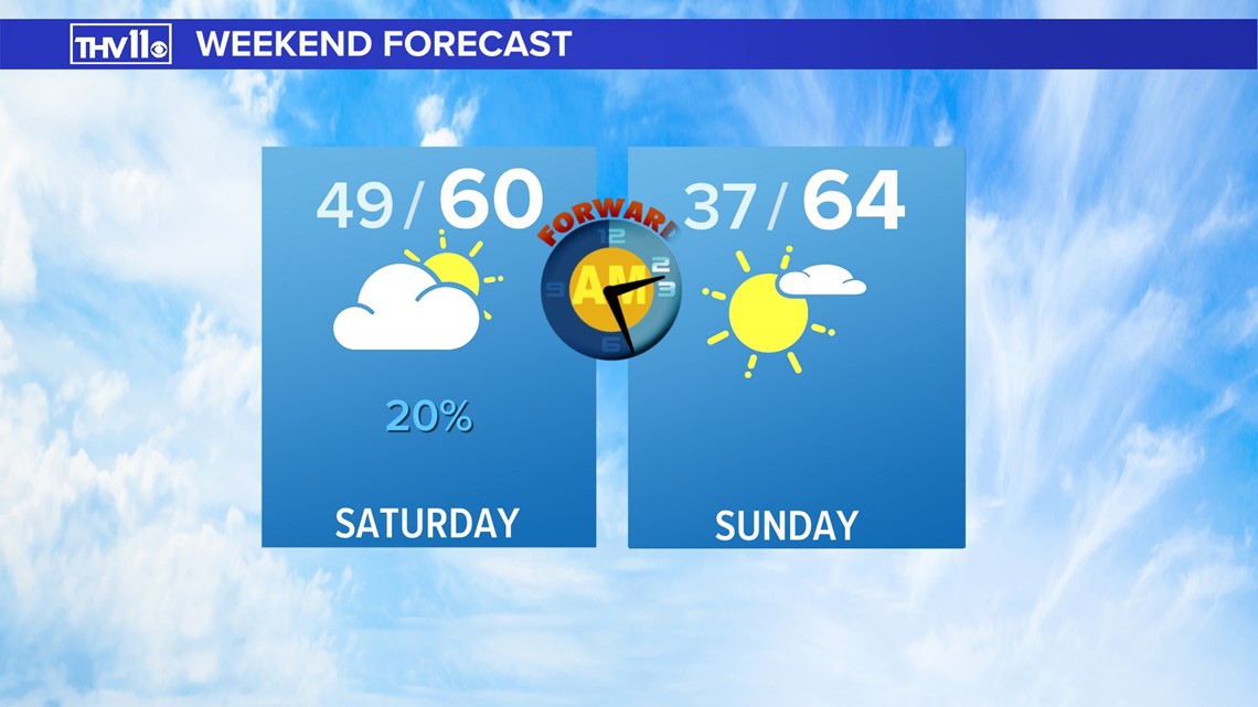
Patchy drizzle or a shower will greet us early Saturday morning. The clouds will gradually clear west to east through the morning into the afternoon. It will be breezy with sunshine returning for the afternoon.
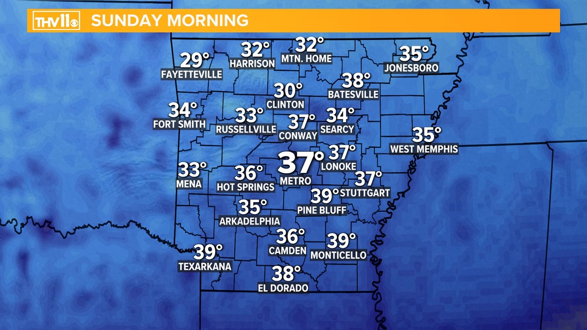
Sunday morning with clear skies and calm winds the temperature will plunge into the 30s area wide. Patchy frost or a freeze will be possible in outlying areas but especially N and W of the Little Rock metro.

Plus, don’t forget to “Spring Forward” and set your clocks ahead one hour Saturday night before going to bed as Daylight Saving Time gets underway!