UPDATED — July 14, 3:45 p.m.
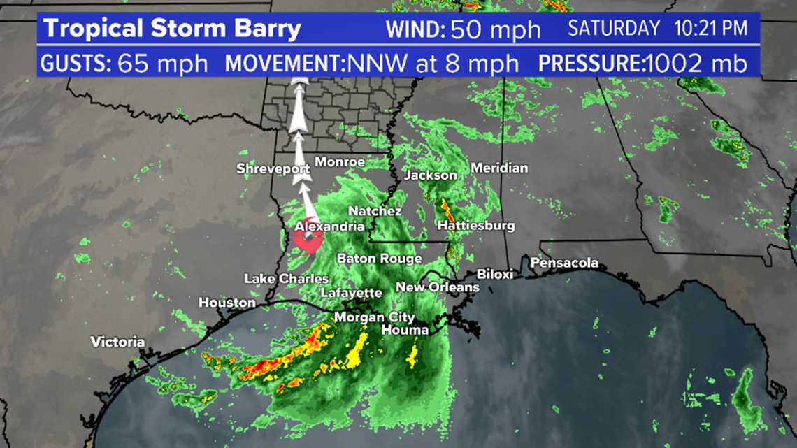
Barry has been downgraded to a tropical depression. Hurricane Barry did make landfall near Intracoastal City, Louisiana.
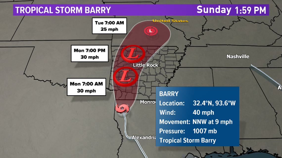
Barry made landfall in central Louisiana yesterday. It's expected to rapidly weaken as it moves inland across the state. There are no hurricane warnings currently in effect.
The main concern with this system is the conveyor belt of heavy rain that will cause flooding in east and central Louisiana and extending into South and central Mississippi. There will be a narrow swath of rainfall totals of 10 to 20 inches in this region. Major flash flooding and river flooding is possible.
Make sure to check the potential of closed roads due to flooding in these areas through Tuesday.

WHAT TO EXPECT IN ARKANSAS
The track of the center of the system has shifted a little west, therefore, expect a combination of gusty winds, heavy rain and even the potential of weak spin-up tornadoes today and possibly into tomorrow.



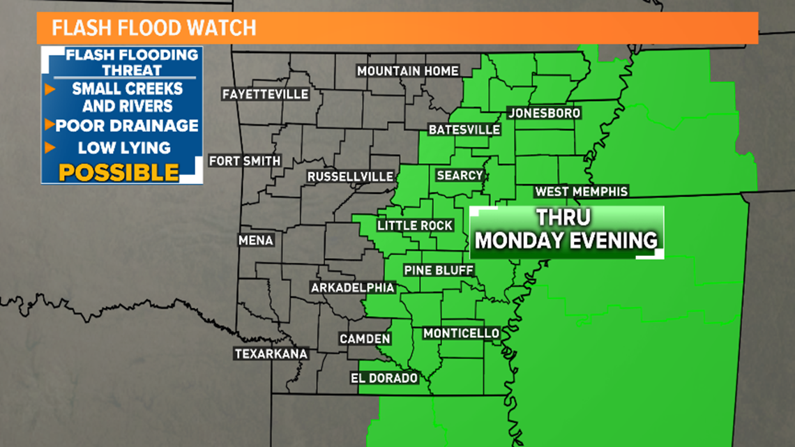
A flash flood watch has been issued for half of the state including the Little Rock metro through Monday evening.

TIMING OF EFFECTS:
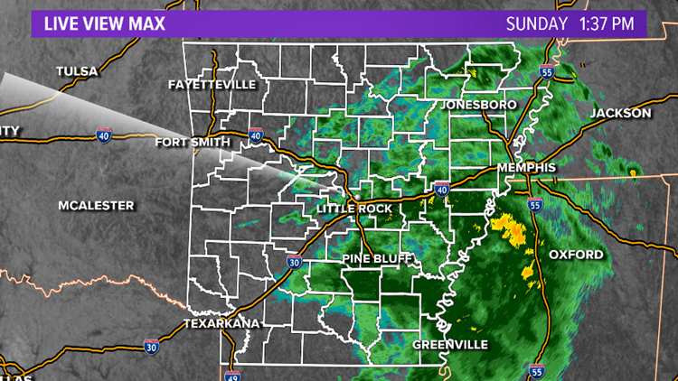
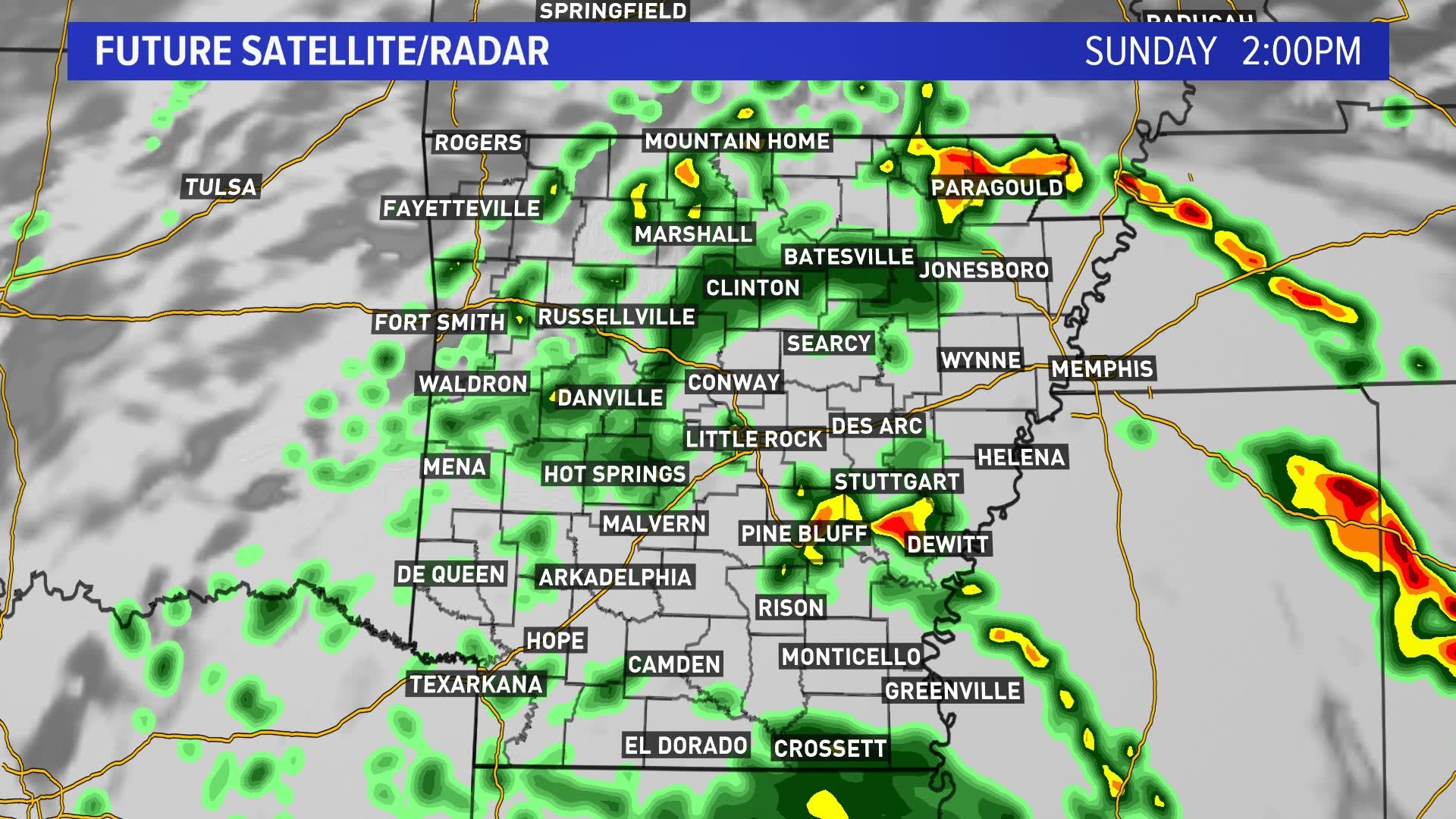
The first effects of Barry will be the chance of scattered showers and storms developing across the area on Saturday afternoon and evening as the outer bands of Barry spiral north. The winds will begin to pick up tonight about 10 to 20 mph. A band of steady to heavy rain will move from Louisiana into Arkansas late tonight and spread north through Sunday.
Early Sunday morning into Sunday night, several inches of rain could fall across the region leading to flash flooding. The heavy rain and gusty winds stick around through Monday.
Finally, by Tuesday the steady rain will end but there is still the chance of scattered showers and storms popping up.
WHAT YOU NEED TO KNOW:
The worst weather from this event will be Sunday afternoon into Monday afternoon.
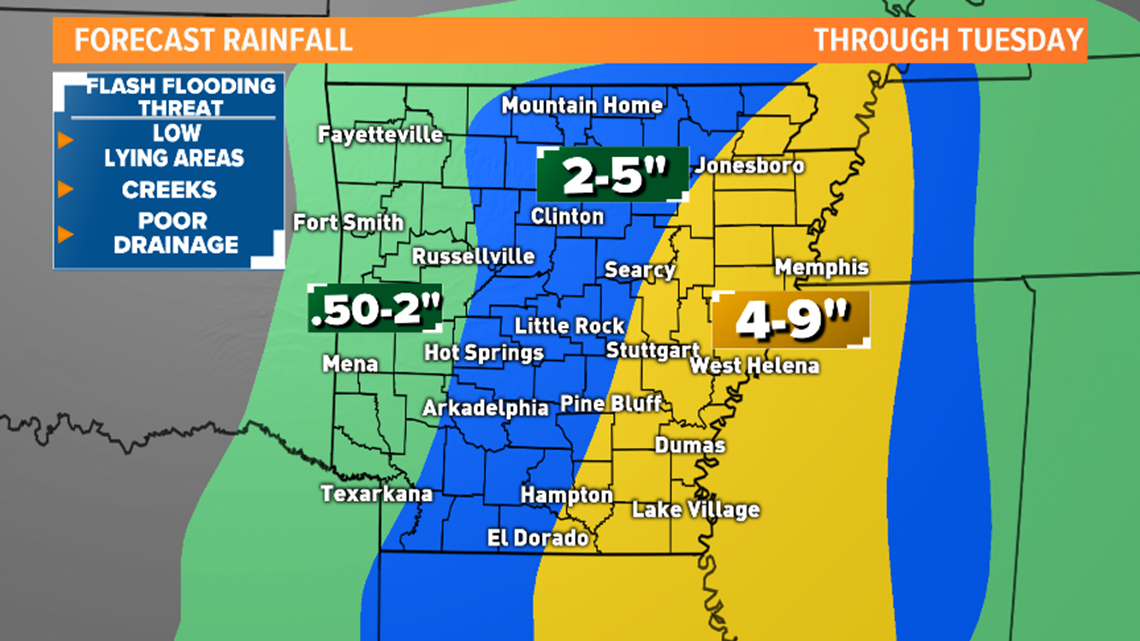
The highest impact from Barry in Arkansas will be several hours of heavy rain that will cause flash flooding in parts of the state. The heaviest rain totals will be in East Arkansas.
Below shows a map of expected rainfall totals starting today through Tuesday.

Sustained winds of 15 to 30 mph will be common across the natural state. The highest gusts will be in Eastern Arkansas. Isolated to scattered power outages will be possible.


Since we are on the “dirty side” or Northeast and East sector of the center of the system, there is a low possibility that some showers and storms may rotate and produce quick brief weak spin-up tornadoes.
The Storm Prediction Center has placed most of the state under a marginal risk of severe weather on Sunday.


SOUTHEAST AND EAST ARKANSAS:
With the center of circulation expected to be west of this part of the state, that places the delta areas under the highest risk of flooding rain, gusty winds, and the potential of spin-up tornadoes going into today and tomorrow. Four to nine inches of rain possibly more will cause flooding in poor drainage areas, low lying areas, creeks, and rivers. Winds will be sustained at 20 to 35 mph with wind gusts at 40 to 50 mph. Isolated to scattered power outages are possible.
Some towns and cities that will see the highest impacts include Pine Bluff, Monticello, Stuttgart, Wynne, Forrest City, Des Arc, Jonesboro.
CENTRAL ARKANSAS and LITTLE ROCK METRO
The center will be close to the region so it will be windy today and tomorrow. Winds will be sustained at 15 to 30 mph with wind gusts 30 to 40 mph. Isolated to scattered power outages will be possible. Small tree limbs and weak trees could fall down.
A steady rain heavy at times will move from South to North or Northwest. Heavy rain will linger over the area through Monday.
Also, the chance of spin-up tornadoes cannot be ruled out on both days.
WEST ARKANSAS:
With the forecast track drifting farther West even this part of the state will see rain and breezy conditions, however, it looks to stay out of the chance of any severe weather.
Stay tuned for the latest updates on THV11 and keep checking back for updates on this article.


