LITTLE ROCK, Ark. — The weather pattern through the weekend will stay active in the middle part of the country as an extensive storm system swirls through the region.
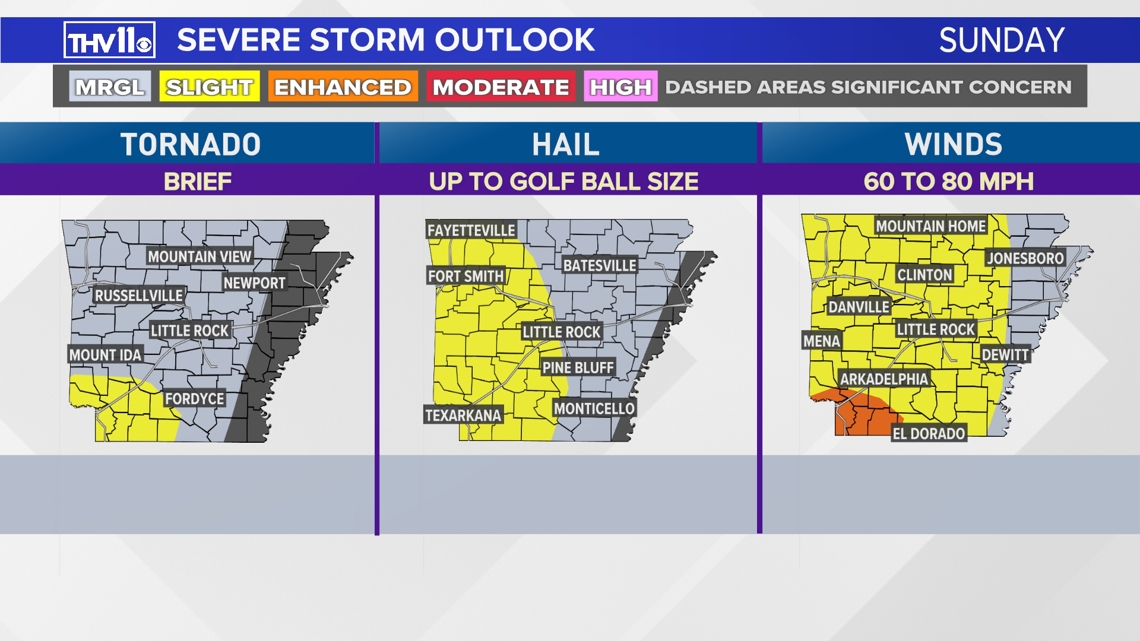
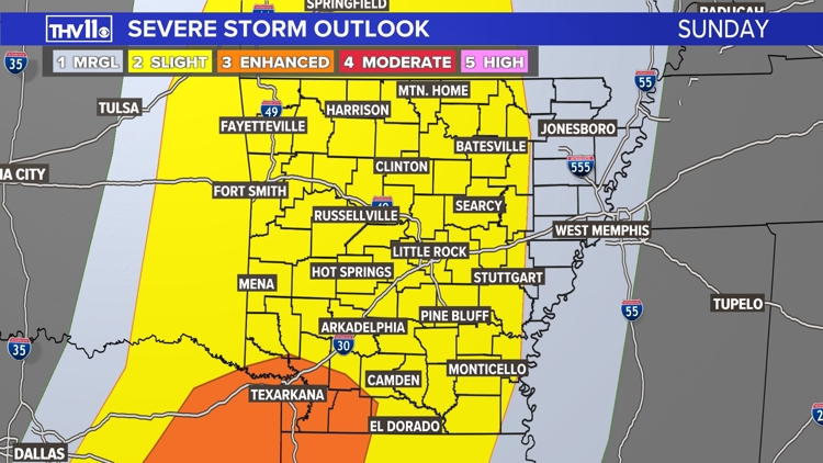
It's important to stay alert later on Sunday as the next round of potentially severe storms will build from the west to the east in the afternoon into the nighttime. Currently, a large part of central Arkansas is under a slight risk of severe weather, coming in at a level 2 out of 5.
Throughout the day, the THV11 Weather Team will be watching for a few storms that could produce hail, high winds and tornadoes.


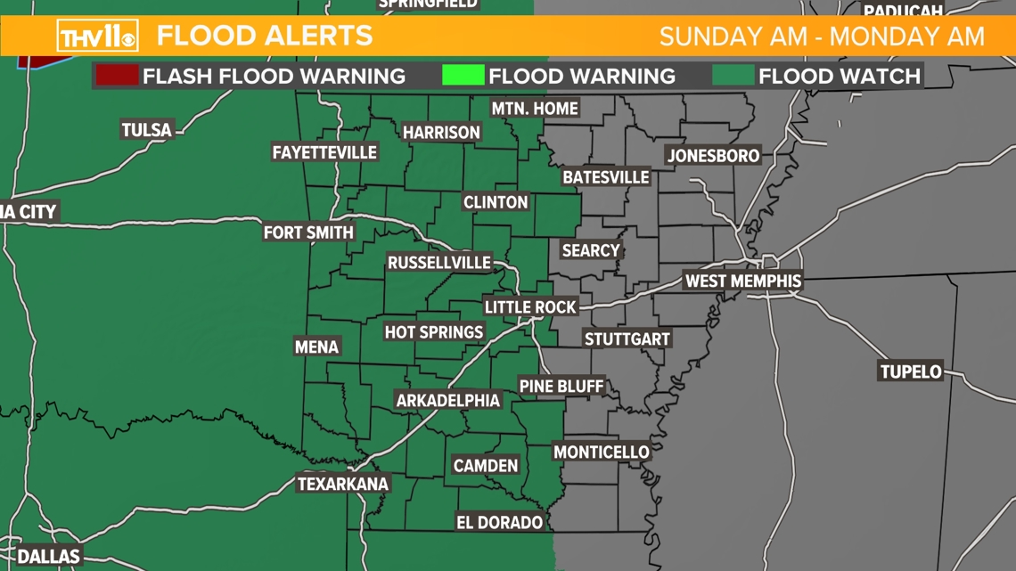
Transitioning from the weekend into the upcoming work week, heavy rainfall late Sunday into Monday morning could cause flash flooding in smaller creeks and rivers. It could also cause issues for low-lying areas and poor drainage areas.
Most locations will see 2 to 3 inches of rain, but some neighborhoods could easily exceed 4 inches. As of Saturday afternoon, the National Weather Service in North Little Rock has issued a Flood Watch from Sunday morning to Monday morning.


As always, we appreciate your weather reports, pictures, and videos, but your safety is our primary concern. Don't risk your safety by getting a photo or video.
You can text your reports or pictures to 501-376-1111 or submit them to our THV11 Facebook page or X account.
Stay alert and be prepared for rapidly changing weather conditions over the next several days. The THV11 Weather Team will keep you informed and updated on the active weather.


