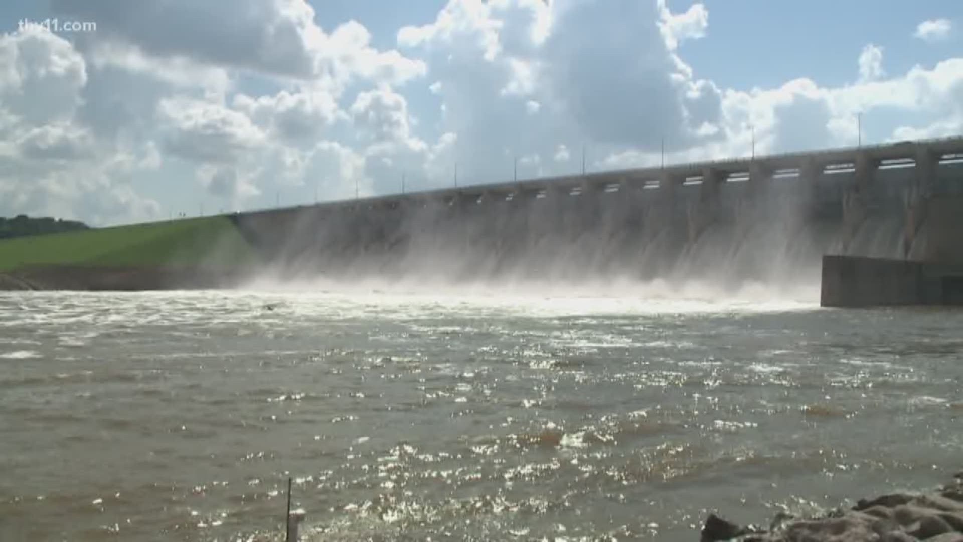
TULSA, Okla. — One month after historic flooding in Arkansas, and six weeks after storms in northeast Oklahoma, a dam above Tulsa is still doing its job while dramatically churning the waters of the Arkansas River.
People cast fishing lines more suited for open seas into the turbulent water, and waves crash on the rocks at Keystone Dam. It’s hard to believe the area is almost 600 miles from an ocean based on the sounds at the site.
The Keystone is managed by the Army Corps of Engineers, Tulsa District, and is one of a handful of dams that manage the Arkansas River as it winds from tributaries in Colorado, down through Kansas, and filling into reservoirs north of Oklahoma’s second-largest city.
That is where the McClellan-Kerr Navigation System begins it’s journey southeast into Arkansas, eventually to its confluence with the Mississippi.
In May, record rains caused the historic flooding that led to tens of millions of dollars’ worth of damage all along that river’s path. But as people in Arkansas continue to clean-up, they are asking why it got so bad there when it rained so far north in Oklahoma above those controlling dams.
The answers come from within a golden tower near Oral Roberts University, where the Tulsa District is based.
“It was the volume. It was the location. And it was the coverage,” said Dr. David Williams, the head of hydrology for the Tulsa District with the simple explanation of how the flood got started. “We're talking about a very large area that saw a lot of rainfall.”
Tulsa and Little Rock look very similar from the banks of the Arkansas, with a few notable differences.
Tulsa is protected by those dams and reservoirs and they have kept the city from a major flood for 33 years. Development has moved right to the water's edge over that time. But this spring, when soaking thunderstorms drenched areas upstream, the reservoirs filled, the gates had to be opened, and the danger grew for all of that developed and populated area.
“We got to a point where the storm was so significant, it totally exhausted our flood control capacity and therefore, you saw the larger releases downstream,” Williams said.
“We were getting at the point where bigger releases were going to be damaging much more infrastructure than they already were," he explained. "Once you start increasing from where that release was, you're talking about significant damages throughout the Tulsa area.”
Those releases, measured in cubic feet per second, would surge farther down into neighboring Arkansas.
The Tulsa district monitored those flows as they passed Van Buren and Fort Smith at 150,000 c.f.s. From there, that wave of water would test a shaky levee system diagonally across the Natural State.
“Immediately I thought, I need to call our sponsors to let them know what was going on, to give them an idea, so that they could be prepared for this event,” said Elmo Webb, the program coordinator of the Army Corps’ levee system in the Little Rock district. “Our main goal is life safety, and those people's lives were at risk if those levees failed.”
Webb knew where the trouble spots were in his state’s levees. Williams knew the dangers of sending the water flowing at that rate downstream. But to protect Tulsa, there was nothing they could do. Both men knew all they could really do was hope.
“The flood was so large, Keystone could have been started from a dry dam and we would have been at 275,000 cubic feet per second release for this flood,” said Williams. “There was nothing we could do.”
Furthermore, there was nothing more the Corps should do, based on their Water Management Plan. It’s decades old and is authorized by Congress. If anyone in Arkansas or elsewhere in the flood-prone Midwest or Great Plains wants to change that, they have to call Washington.
“We have a Congressionally authorized plan, and that dictates how we operate both in normal conditions and also during a flood,” Williams said. “Based on that plan, this event was textbook.”
Williams points out there will be an after-action report generated later this fall. That report will be combined with input from other sources to see if that flood plan merits revisions.
He warns not to expect many changes. Criticism that the Corps could have lowered the level in the reservoirs to be ready for a surge of water later is swatted away.
Weather forecasting has advanced when it comes to chasing tornadoes and hurricanes, but it remains far too inaccurate when it comes to predicting where rain will specifically fall.
“If we release water to lower the reservoir, we run the risk of it raining right where we are sending that water,” he said. “That would make it worse.”
Instead, Williams and Webb urge riverside residents to focus on getting ready for the next big flood.
“We got to get that message out to the people, to the general public, to let them know that there is a risk to living behind levees,” Webb said.
Governor Asa Hutchinson ordered the creation of an Arkansas Levee Task Force to evaluate those risks and is seeding the panel with $10-million to get started.
Williams manages an area with fewer levees but has a similar warning and wake-up call.
“If you were impacted by the flood, whether it be in Oklahoma or Arkansas, I can't stress it enough, if you're not carrying flood insurance, you have to do so if you live in harm's way,” Williams said.

