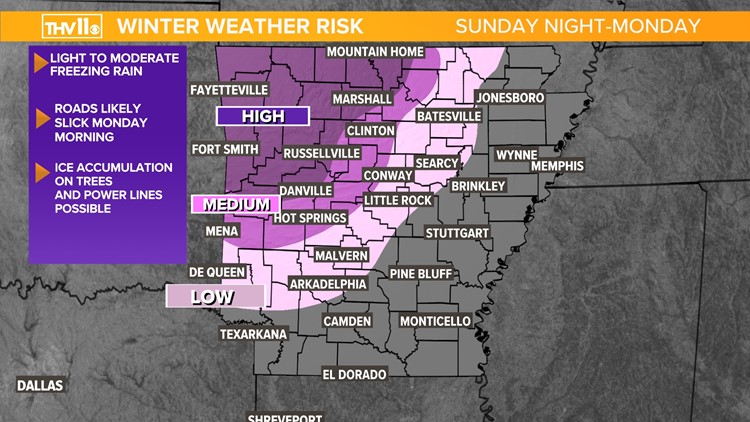
LITTLE ROCK, Ark — Our team is tracking the threat of freezing rain and its impacts on Monday’s morning rush hour.
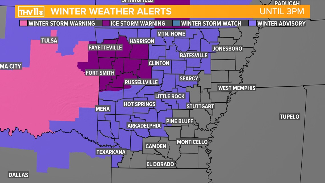
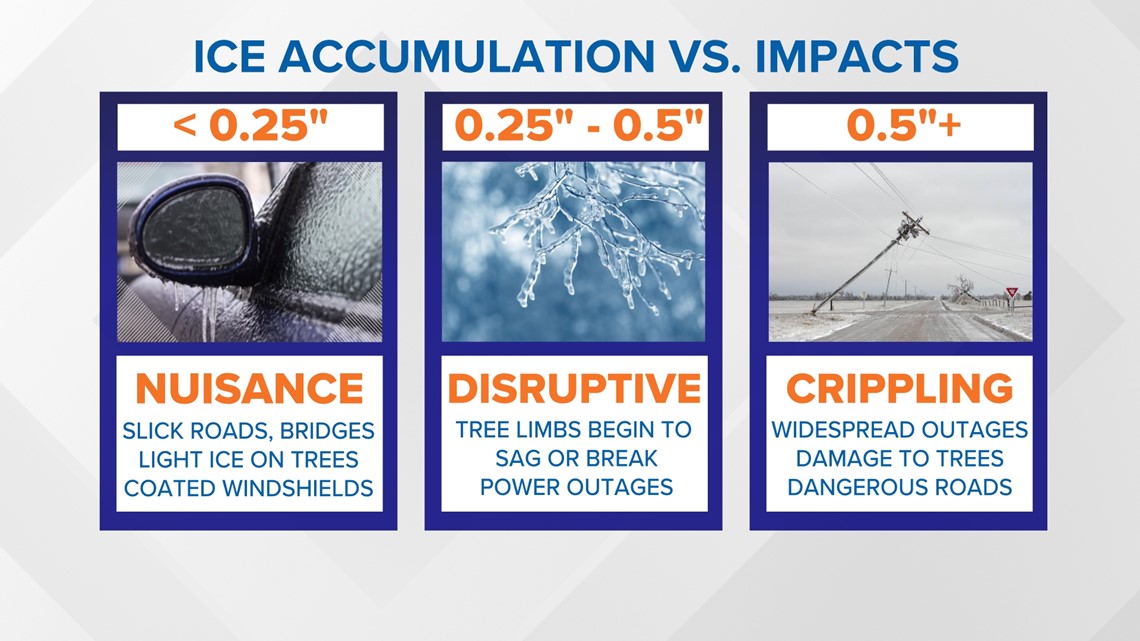
An Ice Storm Warning has been issued for the northwest portion of the state. The warning area includes portions of the Ouachita and Ozark mountains and some Arkansas River Valley counties. This area is expected to see ice accumulations between two tenths to half an inch and wind gusts up to 30mph.
A Winter Weather Advisory has also been issued for portions of western, central and northern Arkansas. The advisory area includes Pulaski County and the city of Little Rock. This area is expected to see ice accumulations up to two tenths of an inch.
Both alerts last through 3:00 p.m. on Monday.


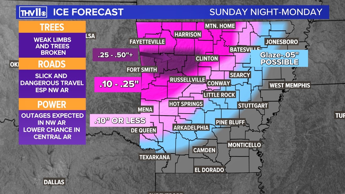
When and what to expect
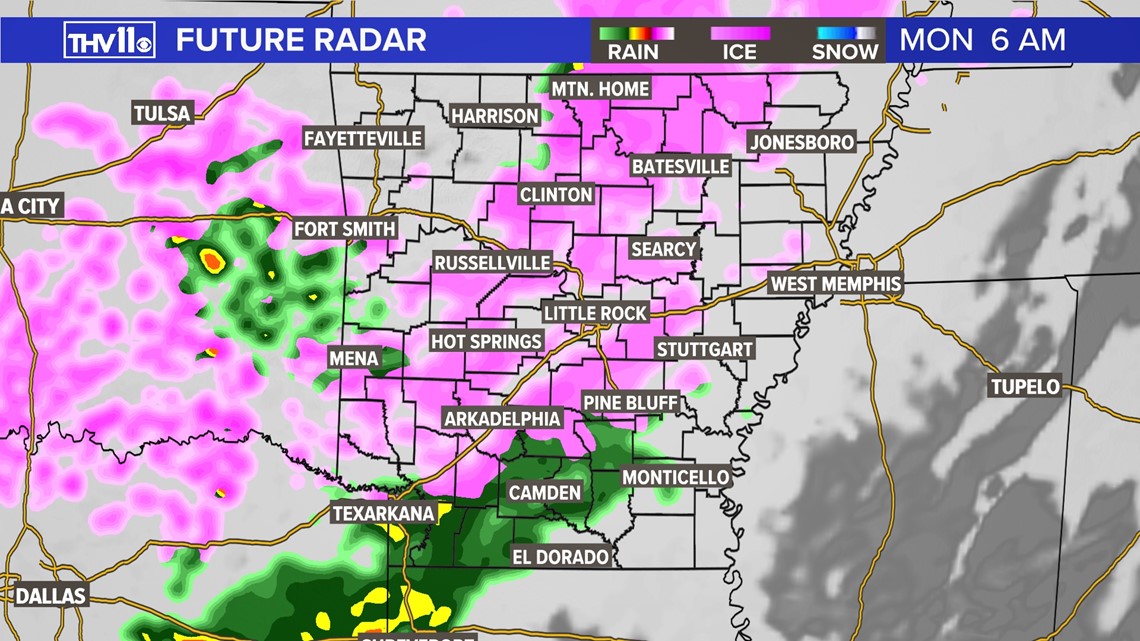
By sunrise, much of central Arkansas will see some form of precipitation. The cutoff from freezing rain to rain will mainly orient from southwest to northeast, thanks to some warm air advection near the surface across south and southeastern Arkansas.

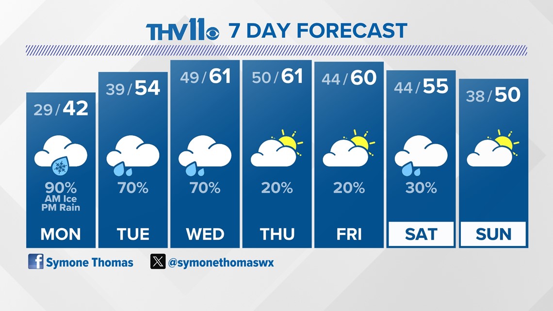
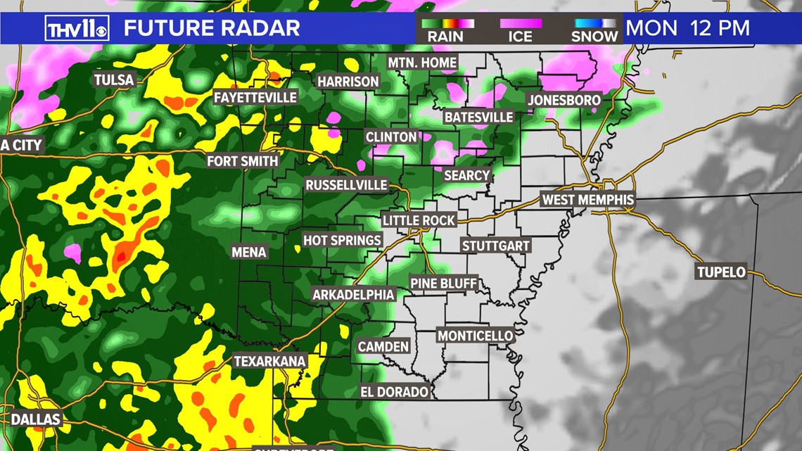
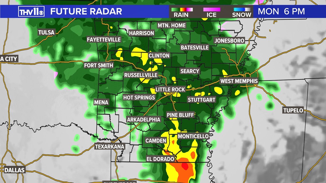
By midday, most precipitation will have transitioned to cold rain, continuing through Monday night.


Due to the timing of this event, your Monday morning commute will likely be impacted. The amount of ice accumulation will determine how disruptive the impacts are. Now is the time to plan accordingly.

Plenty more rain is expected through the week, but there won’t be any more concerns about winter weather. Temperatures are in a warming trend throughout the week, with the peak happening around mid-week.

