LITTLE ROCK, Ark. — Warm and humid air is setting the stage up for the potential of severe weather through late Wednesday night.
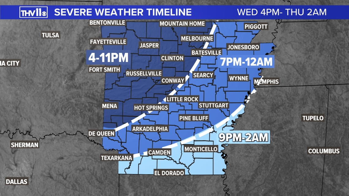
A cold front will sweep through the state and this will be the trigger for a higher potential of severe weather developing later Wednesday evening into overnight.


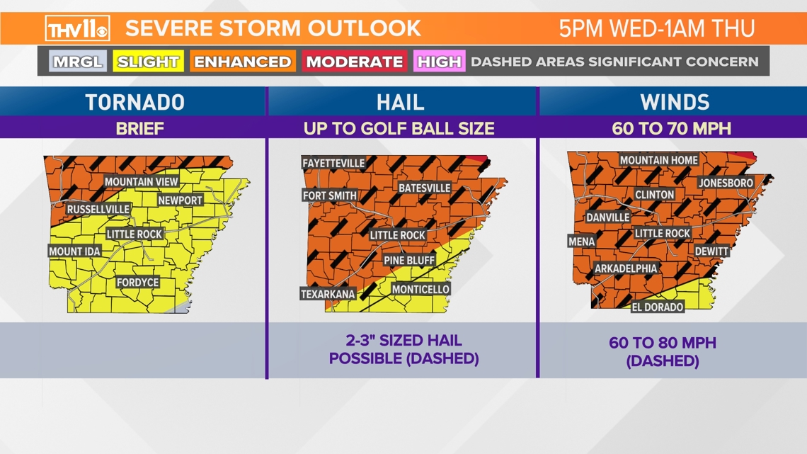
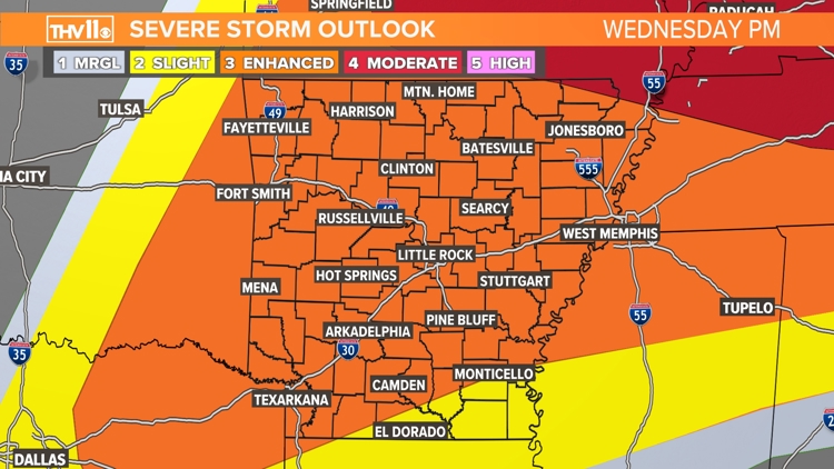
The threat of severe weather on that day is a level 3 out of 5 or "enhanced risk." This means the chance of several significant severe storms is possible. We are expecting plenty of storm fuel in place and also wind energy.


This scenario sets up the potential of supercell storms developing which are capable of not only producing damaging winds, huge hail and tornadoes, but also strong long tracked tornadoes.
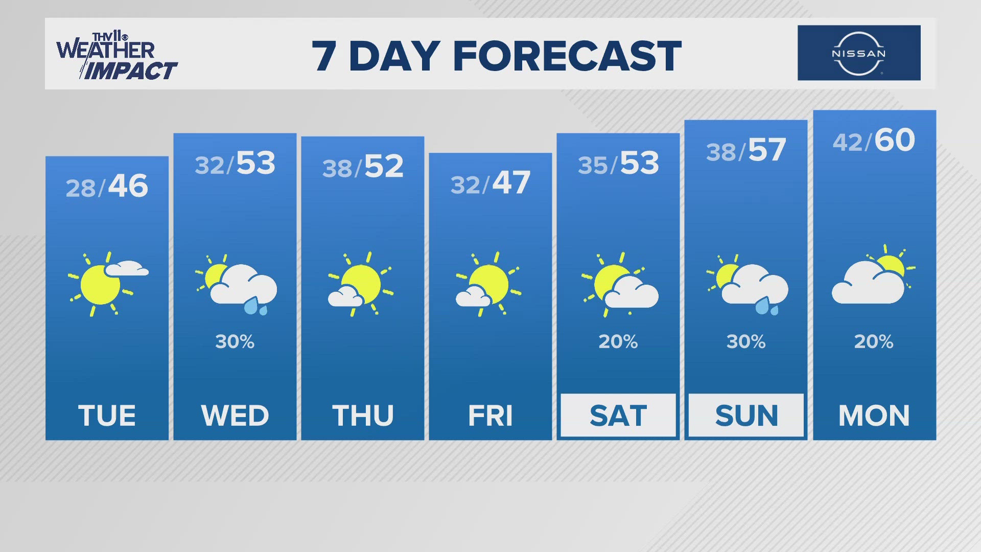
All the severe weather and rain should be out of region by rush hour on Thursday morning. We expect to see more sun and less humidity.
The THV11 Weather Team will be watching the latest model trends and will have all the updates that you need to know this week.
Have several ways of receiving warning notifications including the THV11 app. Also it's a great time to go over your tornado safety plan with your family just in case a warning is issued.


