LITTLE ROCK, Ark. — Spring has sprung in Central Arkansas, and that means severe weather isn't too far away.
In fact, our next chance of strong storms is coming sooner rather than later. We're keeping an eye on Monday as the potential for showers and thunderstorms becomes increasingly likely.

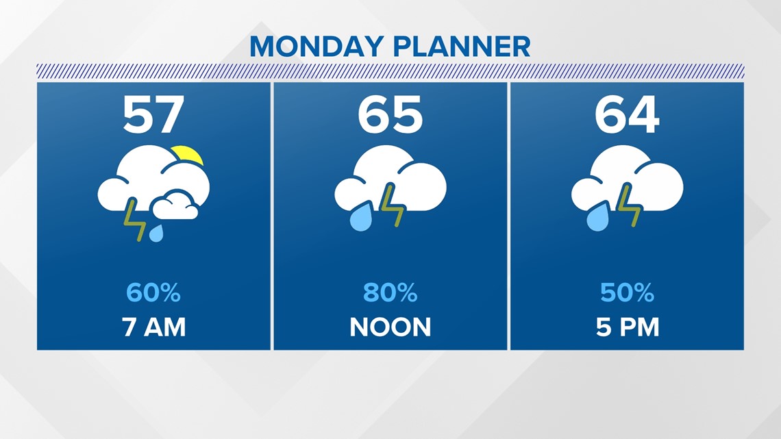
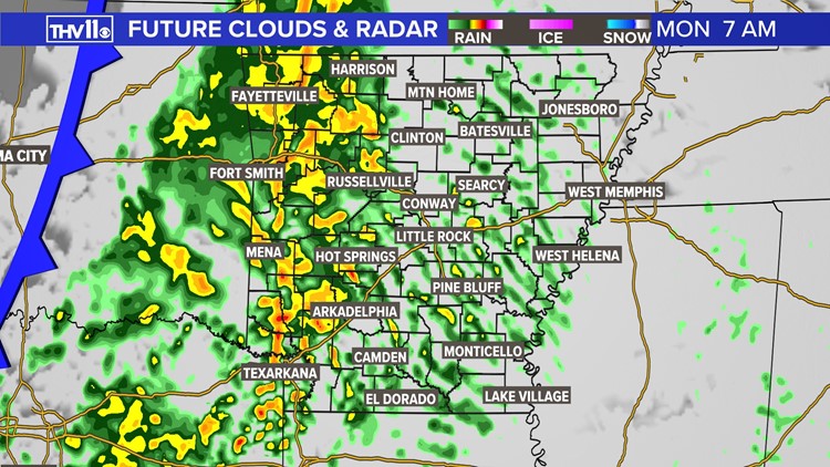
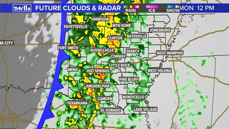
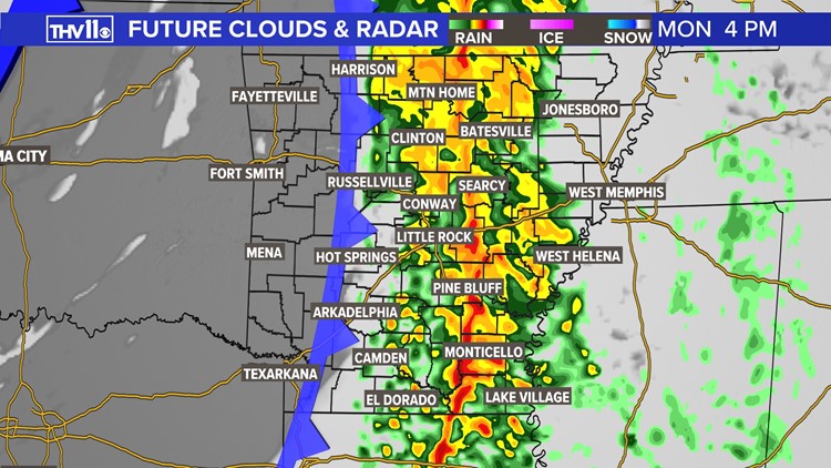
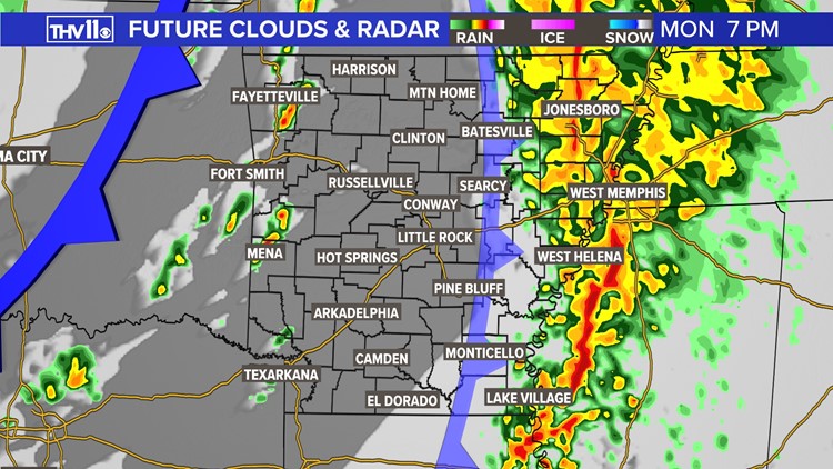
You'll want to pack the rain gear on Monday because Central Arkansas could start to see rain showers as early as rush hour. Primetime thunderstorm development will occur Monday afternoon into Monday evening, as the storm system and associated cold front moves through.
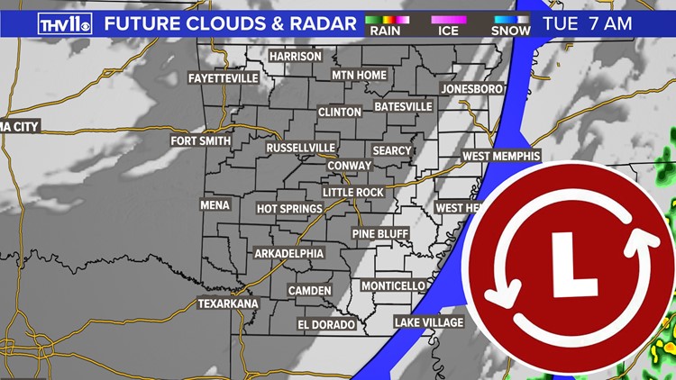
A second, drier cold front will move through late Monday night and cut off the moisture/rain during its passage. Thanks to the second front, clearing skies are expected by Tuesday morning.
Rain and storm timeline
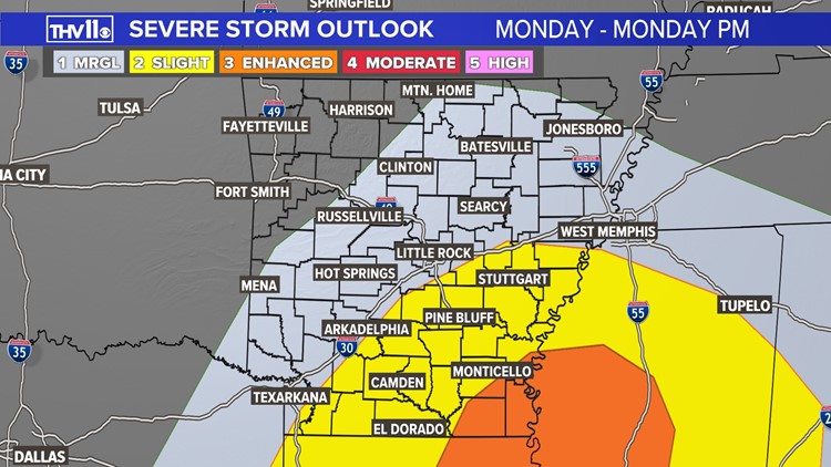
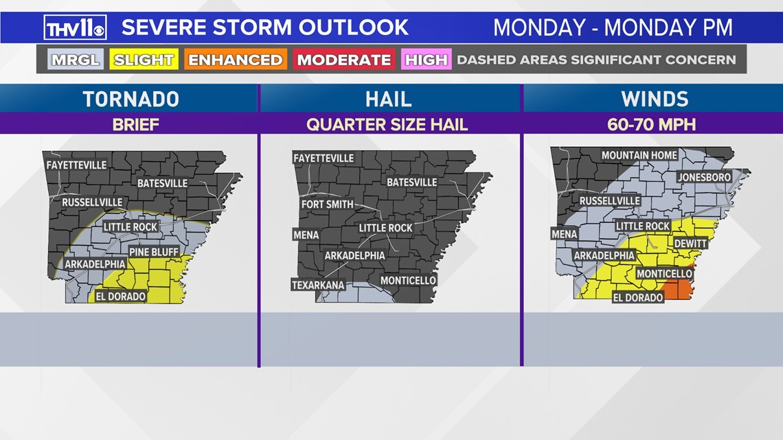
Due to low instability and storm fuel, the main hazards for this event are damaging wind gusts and heavy rainfall. The tornado threat is low, but not zero. This hazard will be most likely across southern Arkansas (near the Louisiana border/Mississippi River Valley). Any hail that develops will likely be too small for severe criteria.

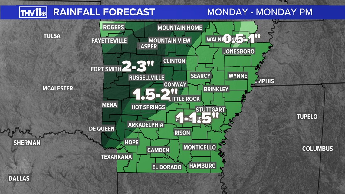
Much of Central Arkansas can expect up to one and a half inches of rain, but two to three inches could be likely in localized areas where heavy downpours occur.

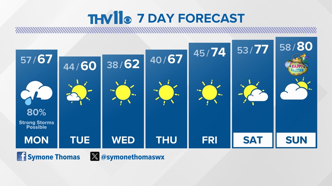
The rest of the week will be full of sunshine and temperatures on a slow climb.

