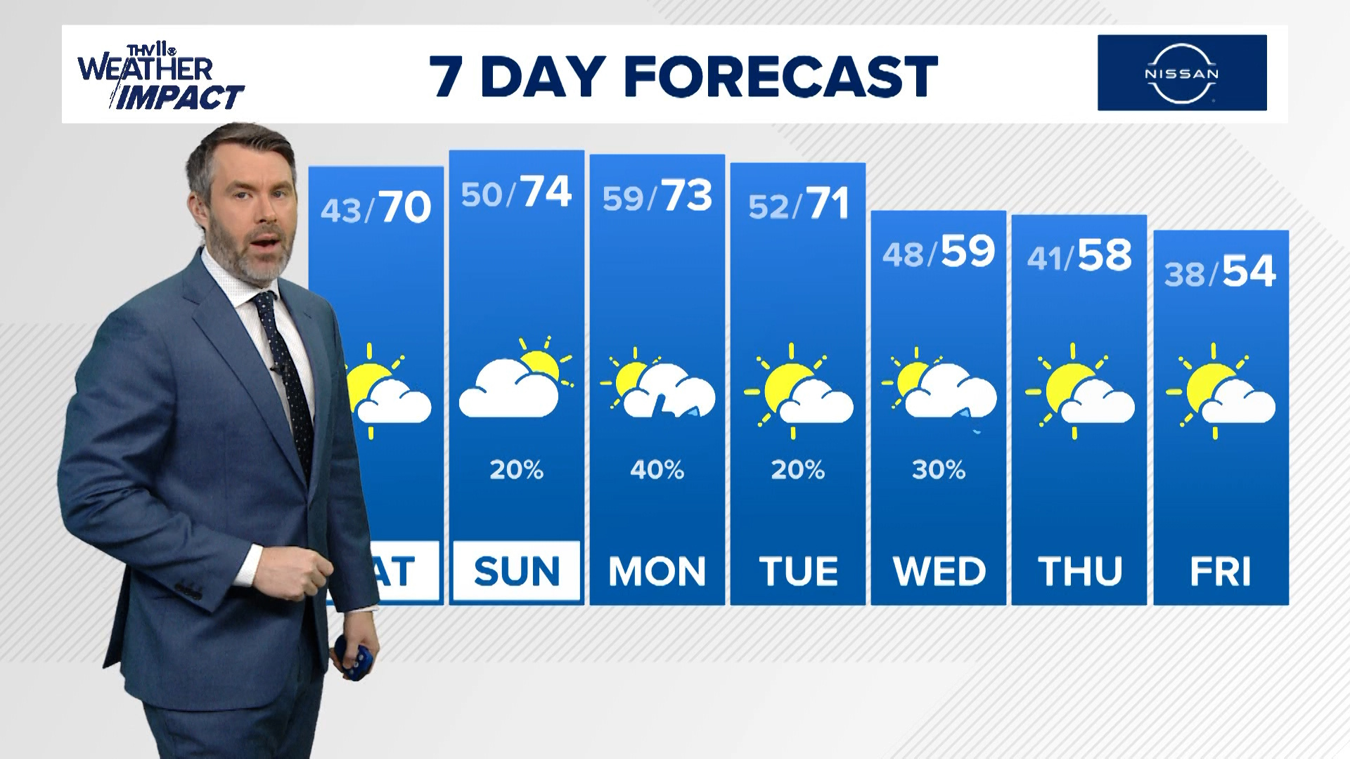
After a gorgeous Friday it may be difficult to believe that severe weather is expected for parts of the state on Saturday.
First is important to note that there will be a sharp cut-off on where the severe weather is possible and it is all dependent of the track of the low pressure and position of the warm front. No severe weather is expected to the northwest of Little Rock.
Check out the map below for which parts of the state could see severe weather starting early as 1 p.m. Saturday for south Arkansas and expanding north through the day until as late as 11 p.m.

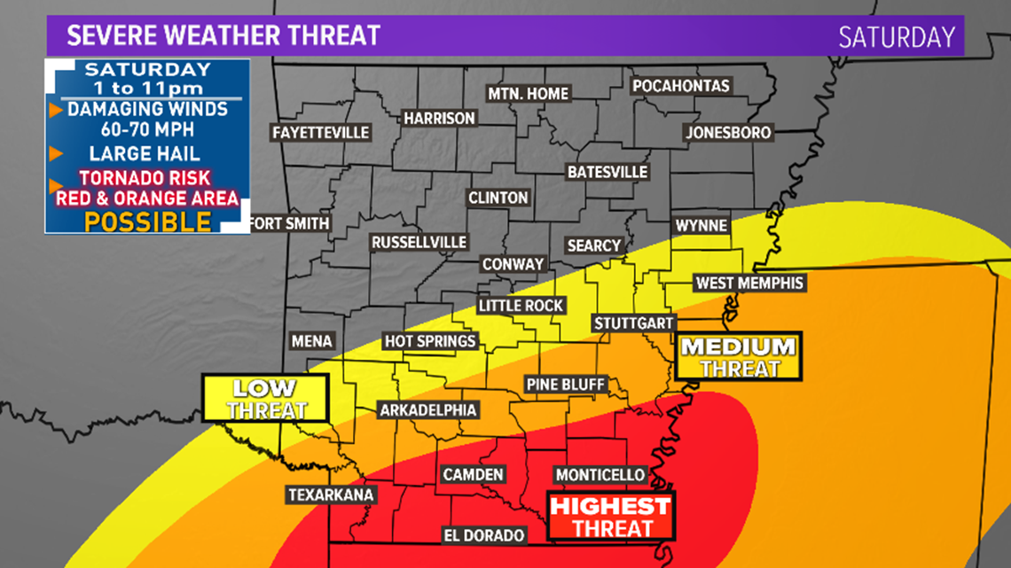
RED ZONE: (Camden, Monticello, Warren, El Dorado) Severe Weather Likely, with storms in the afternoon and evening possibly producing large hail, damaging winds, and tornadoes (including strong and long-tracked).
ORANGE ZONE: (Pine Bluff, Arkadelphia, Stuttgart) Severe Weather Possible with storms in the afternoon and evening capable of producing damaging winds, large hail and a weak spin-up tornado.
YELLOW ZONE: ( Hot Springs, Little Rock) Low risk of severe weather but some storms in the evening could produce damaging winds and large hail. Tornado threat low.
WHAT YOU NEED TO KNOW:
Stay weather aware.
Download the THV11 app and make sure you have settings to allow weather alerts.
Make sure your NOAA radio is good to go.
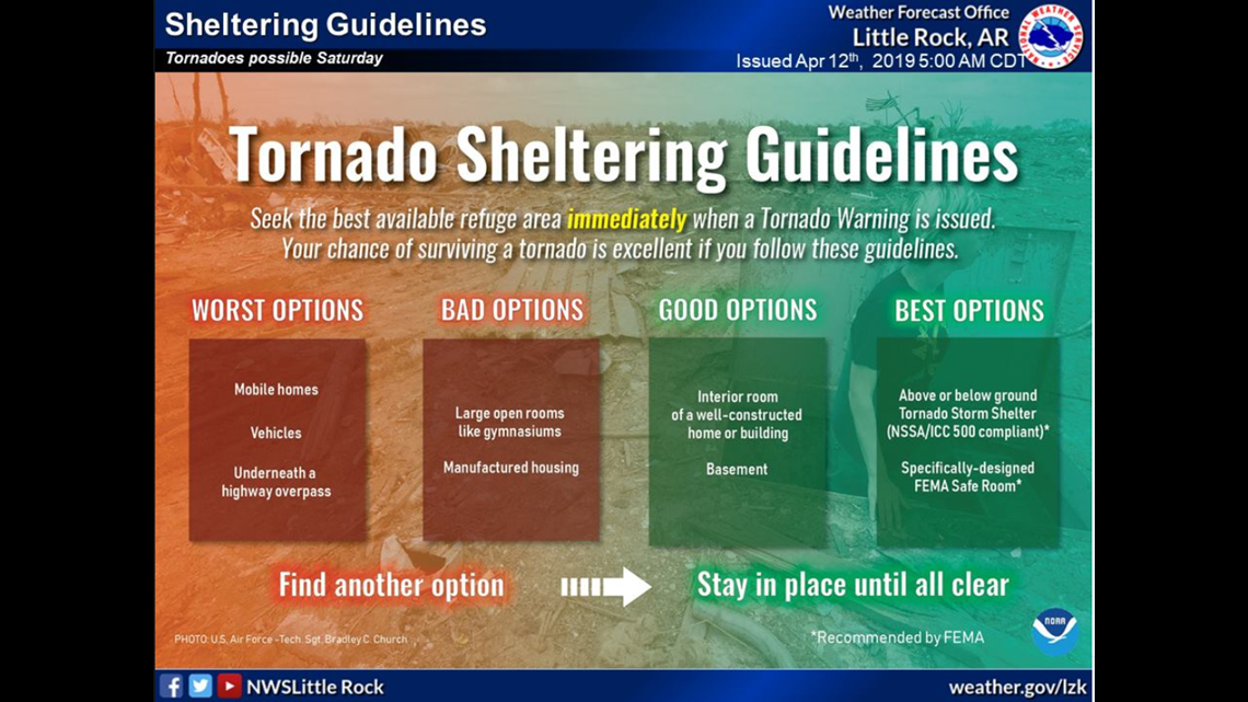
If you live in a mobile or manufactured home have a place to go that is much safer, a shelter, another home that is well constructed and anchored to the ground with interior rooms that do not have windows.
Below is some advice from the National Weather Service on tornado safety.

EXPECTED SCENARIO:
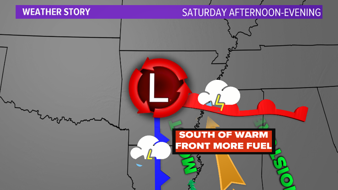
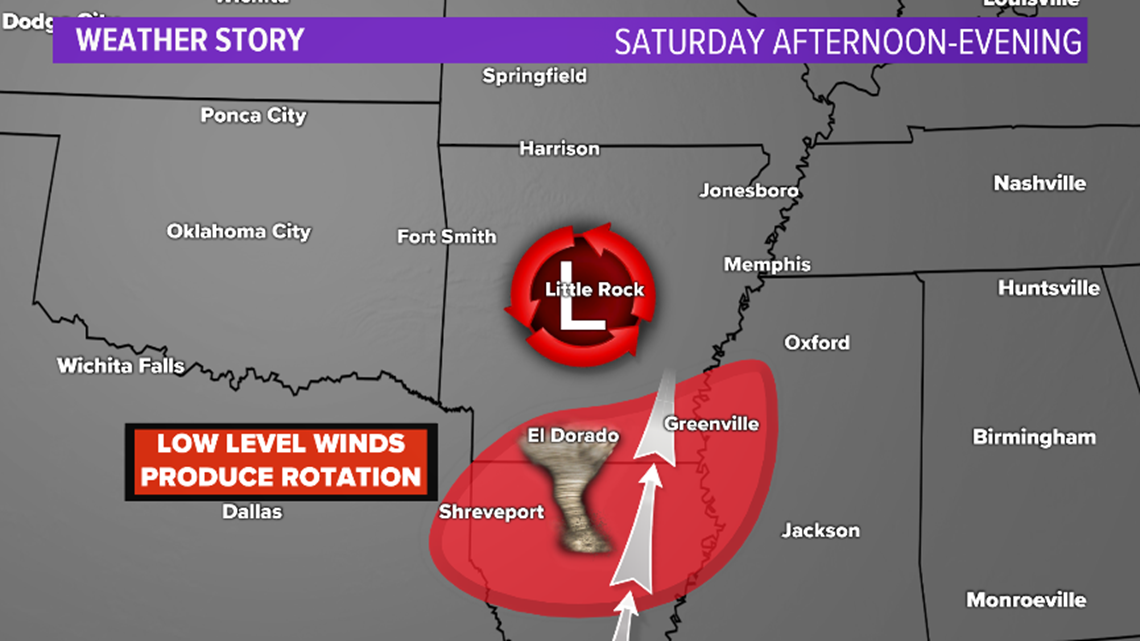
A low pressure system will develop in east Texas and swing across central Arkansas through the day on Saturday dragging a cold front through the area Saturday evening. As the low develops it will pull in warm and moist air from Louisiana into southern parts of the state. This will set the stage for the potential of severe weather in this area.
The tornado risk is high in southeast Arkansas because there are high winds about 5,000 feet that will cause the storms to rotate in this region.


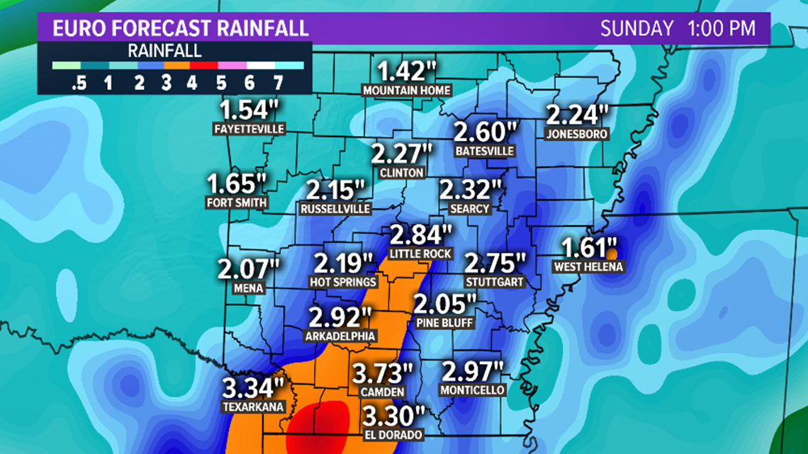
FLASH FLOODING:
Heavy rain through the day could cause smaller creeks and streams to rise out of their banks. Water could also pond in low lying or poor drainage areas. Rainfall totals from this event will range from 1 to 3”. Isolated locations could see more if heavy rain falls in a location for a long period of time.

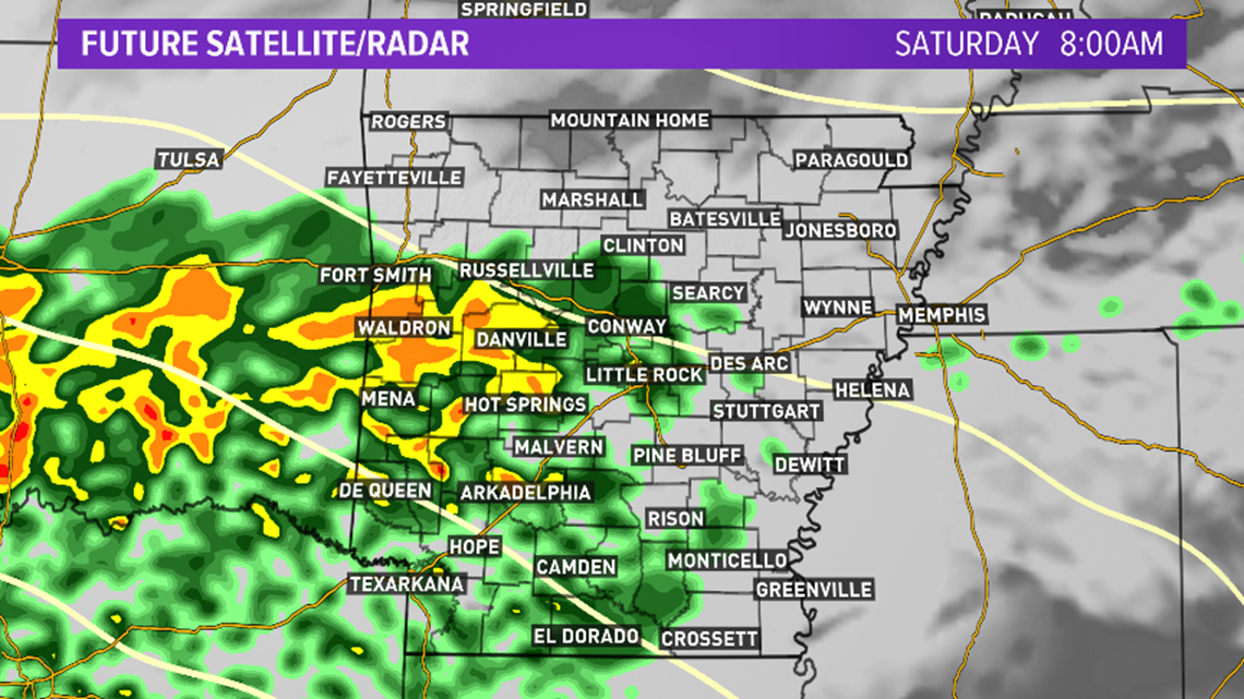
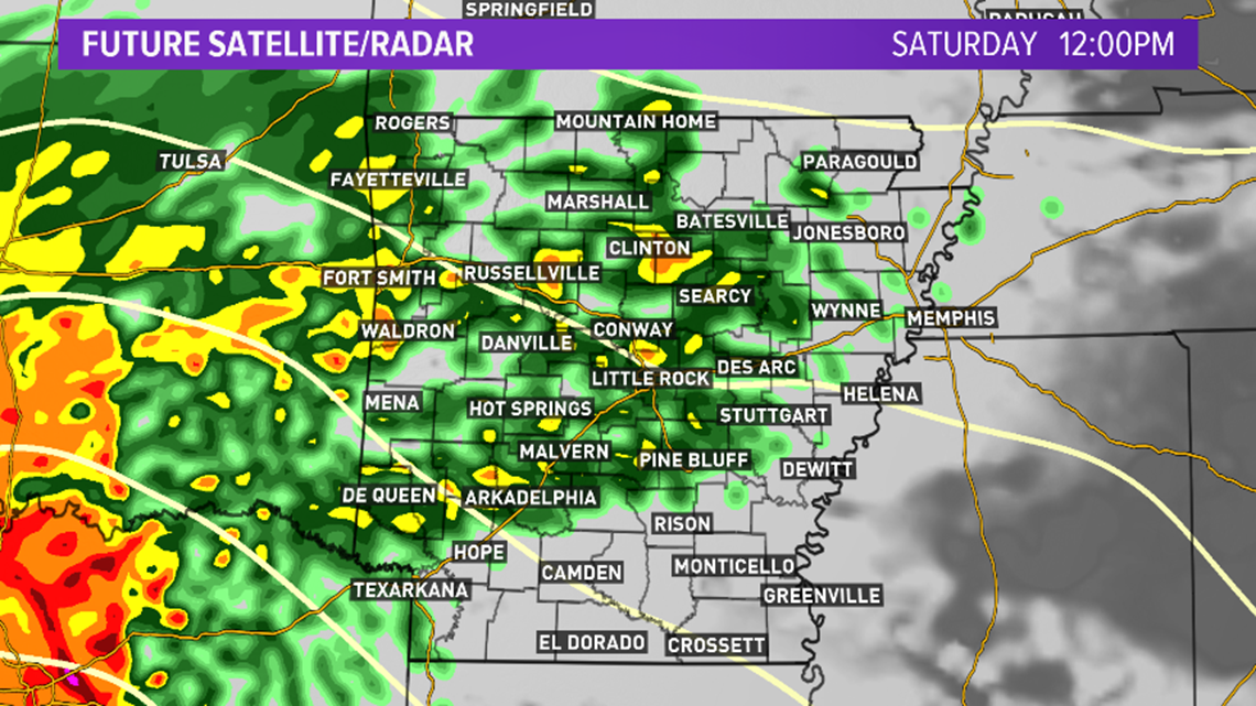
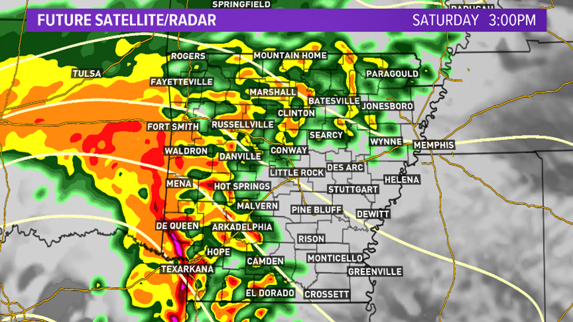
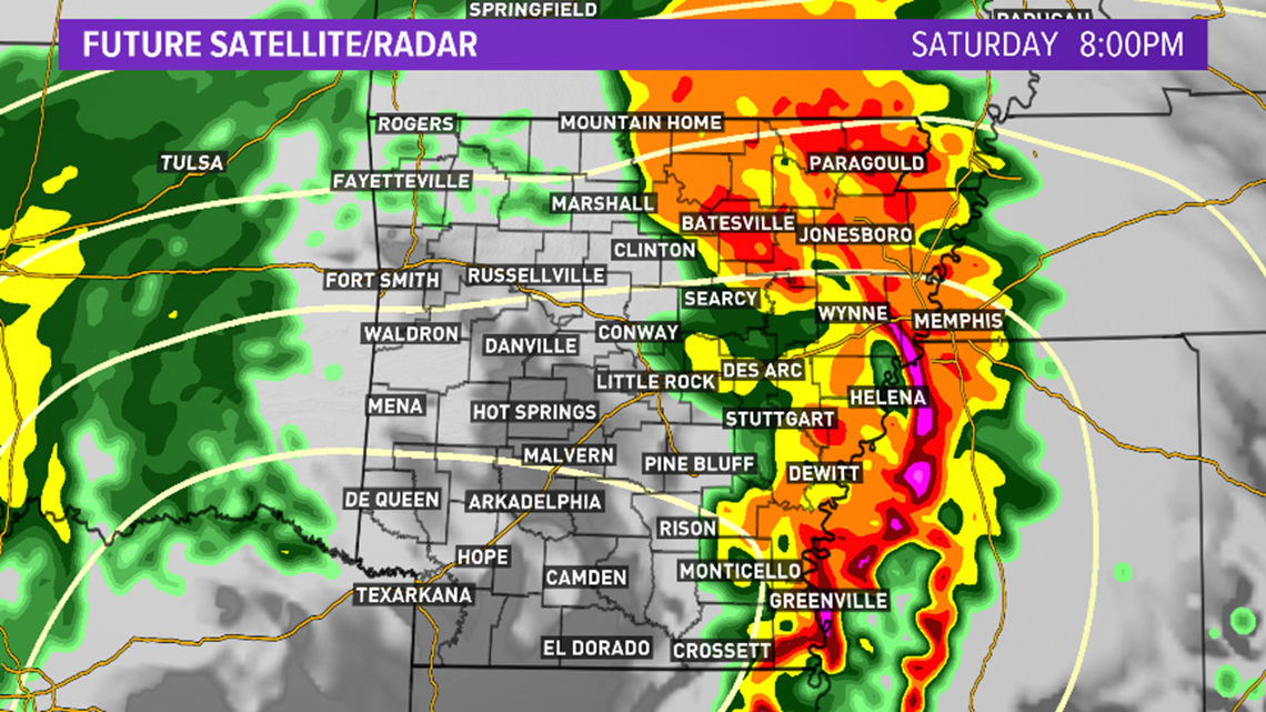
FUTURE RADAR: The time could be off a couple of hours.
Below shows what the radar is expected to look like through the day. We will be watching the potential of supercells developing in the RED ZONE ahead of the cold front as it charges through Saturday afternoon and evening. The threat of severe weather should be done for Arkansas by 11 p.m.
If there is sunshine in southeast or south Arkansas, the threat of severe weather will increase. Sunshine in this set-up is like adding fuel to the fire.

