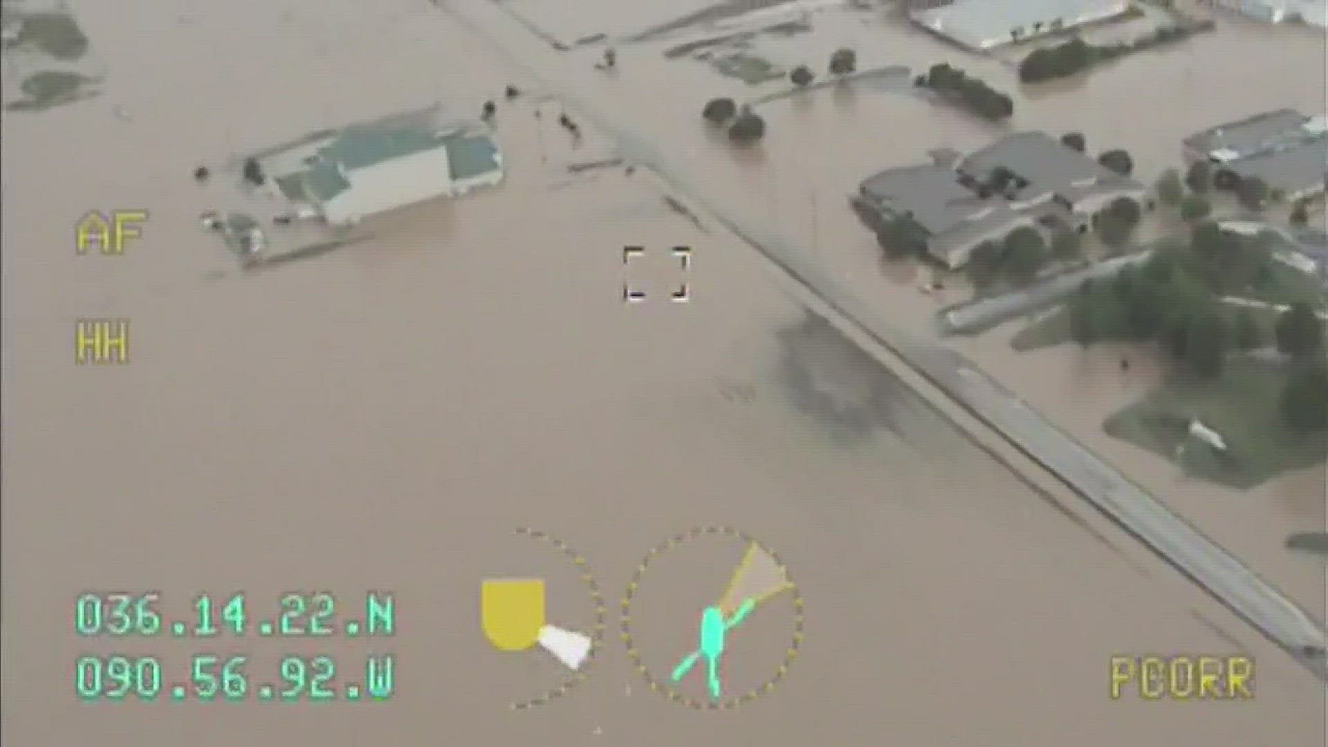
Another round of severe weather in the Natural State is expected to bring more flooding troubles for people in northern Arkansas. Below are the latest updates on the severe weather for Wednesday, May 3.
7:00 P.M.
A flash flood warning for Clark, Cleveland, Dallas, Garland, Grant, Hot Spring, Jefferson, Lonoke, Ouachita, Pulaski, and Saline counties has been extended until 9:15 p.m.
Several county roads are under water due to flash flooding in Sheridan.
5:20 P.M.
Governor Asa Hutchinson has asked for additional resources to help parts of northern Arkansas which has been hit by severe flooding. The resources include more than 100 members of Arkansas's National Guard and 25 vehicles. Those vehicles will be used for water rescues if needed.
Hutchinson advised residents of the area to listen to officials and follow any instructions given.
[Source: Associated Press]
4:50 P.M.
Flash floods are being reported in Gurdon, Whelen Springs, and Des Arc. In Gurdon and Whelen Springs, the flash flood has been reported happening along Highway 53. The National Weather Service is reporting that the flash flooding is two and a half feet over parts of Highway 7 in Dalark.
There are also reports of several roads in Dallas County having 3 to 4 inches of water covering the road.
3:45 P.M.
Reports say there is flash flooding south of Arkadelphia near Hollywood on Highway 26.
The National Weather Service has also extended the flash flood warning for Clark, Cleveland, Dallas, Garland, Grant, Hot Spring, Jefferson, Lonoke, Ouachits, Pulaski, and Saline counties until 6:15 p.m.
If you have any pictures of video of the weather or any damage, please share them with us by sending an email to news@thv11.com or using the hashtag #beon11 on social media.
2:00 P.M.
At a press conference in Randolph County, officials told members of the media the current flooding damage in the area. As of right now, there are a total of 50 homes that have been lost due to flood damage and another 150 damaged across the county.
The levee has been breached a total of 9 times, with 3 major breaches and 6 more that are considered minor. Officials don't expect more breaches, but they are expecting the current breaches to worsen. A total of 5 people have been rescued by safety boat as well as a "large amount of pets."
The town of Reno is "completely cut off" and crews have medically evacuated one resident who experiences some breathing complications. They also say that snakes and rats are a major problem during the flooding.
Officials are saying this flooding event is worse than flooding from 2011. They say this is another "historic crest of the Black River."
Officials say flooding is worse than flooding from 2011. They say this is "historic crest of the Black River." #arwxhttps://t.co/HOxinBLH0U pic.twitter.com/lh8ZdITHN9
— THV11 (@THV11) May 3, 2017
12:55 P.M.
The National Weather Service is reporting that the severe weather threat looks to be over for the day. According to reports, the combination of rain, cloud cover, and lack of solar radiation has made it unable for the "winds to mix down."
NWS wouldn't rule out hail-producing storms at this moment, but they say as the day moves on it is becoming less likely. They still are predicting that flooding will be a major concern with this storm.
Approximately 1 to 3 inches of rain has fallen in the Polk County area.
12:15 P.M.
A flash flood warning has been issued for Clark, Cleveland, Dallas, Garland, Grant, Hot Spring, Jefferson, Ouachita, and Saline counties. That warning is set to last until 3:15 p.m.
11:40 A.M.
The National Weather Service is reporting that Highway 270 West in Hot Springs near the Piney area is slightly flooded, but heavily flooded as first reported.
The Arkansas Highway and Transportation Department announced on Twitter that they are in the process of closing Highway 63 between Hoxie and Portia in Lawrence County.
Drivers-- avoid these areas https://t.co/zCPQTD6iea
— Erika Ferrando THV11 (@ErikaFerrandoTV) May 3, 2017
11:10 A.M.
A wave of low pressure will bring a round of thunderstorms along with heavy rain. This threat of severe weather is expected to move through the state throughout the day and the threat will dissipate around early evening.
Those living in central and southern Arkansas should expect a risk of large hail and damaging winds. Any rain we receive will further exacerbate the flooding issues in norther Arkansas.
Rain is expected to linger tonight as the windy conditions continue to pick up.
10:30 A.M.
According to the National Weather Service, the levee on the Black River in Pocahontas has failed. The levee was breached sometime around 8:30 a.m. near the town.
Residents in the nearby communities have been urged to seek higher ground. A mandatory evacuation has been issued for parts of Pocahontas.
Stay tuned to THV11 and THV11.com for more information. We will keep you update on the latest severe weather as well as any damage in the state.

