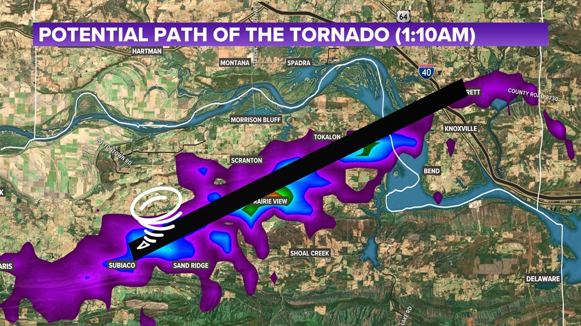
LOGAN COUNTY, Ark. — On Sunday, June 18, the National Weather Service confirmed via radar that an EF2 tornado hit Logan County at around 1:12 a.m.
Winds estimated to be 120 mph went through eastern Logan County for 5.4 miles, according to reports. Officials say the tornado path was 700 yards wide hitting communities in the area.
Estimated Tornado Path


Meteorologist Matt Stanridge says the tornado path is estimated to have traveled in the following order:
- Started East of Subiaco
- Went into Scranton and Prairie View
- Crossed Arkansas River Lake Dardanelle
- Headed into Southern Johnson County near Lamar and Knoxville


Northwest Arkansas and River Valley
Severe winds also made it through the River Valley and Northwest Arkansas causing a lot of damage to the area as well. Meteorologist Matt Standrige explains there were "two large storm complexes" one of which hit the River Valley and the other hitting Northwest Arkansas. Strong winds started in LeFlore County and Talihina and strengthened as they made their way to Arkansas. Winds reaching up to 80 mph headed into Washington and Benton County and weakened by the time it got to Fayetteville.
Overall, the severe weather caused multiple power outages, damaged chicken houses, downed power lines, snapped trees and fences, and damage to homes and businesses. On Sunday morning, over 100,000 OG&E customers woke up to no electricity. Crews have worked on restoring power ever since and have restored over 70% of its customer's electricity. That number came down to 30,231 on Monday morning.
Damage photos:
Watch 5NEWS on YouTube.
Download the 5NEWS app on your smartphone:
Stream 5NEWS 24/7 on the 5+ app: How to watch the 5+ app on your streaming device
To report a typo or grammatical error, please email KFSMDigitalTeam@tegna.com and detail which story you're referring to.

