

LITTLE ROCK, Ark. — Winter weather advisories have been issued for the entire state of Arkansas and continue through Saturday morning.
An arctic front is already moving through western Arkansas, replacing the comfortable temperatures we've enjoyed the last few days.
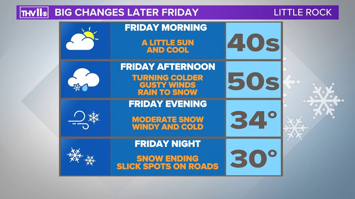
Temperatures may hit the low to mid-50s in central Arkansas before the boundary arrives around noon. South and east of Little Rock may climb into the 60s.
Once the cold front charges through your neighborhood, the temperatures will plummet into the 30s with gusty north and northeast winds of 15 to 25 mph.
Precipitation may start as rain, but will quickly change to possibly a little sleet before going to all snow in the late afternoon and evening.
WATCH LIVE STREAM:
The combination of bitterly cold air and blowing snow will have you looking for the big winter coats and gloves once again.
Friday evening could feature bursts of heavy snow at times possibly leading to reduced visibility and a quick accumulation primarily on grassy areas.
Accumulation potential in most of central Arkansas should be a trace to 2 inches, but there could be a little more if heavy snow banding does develop.

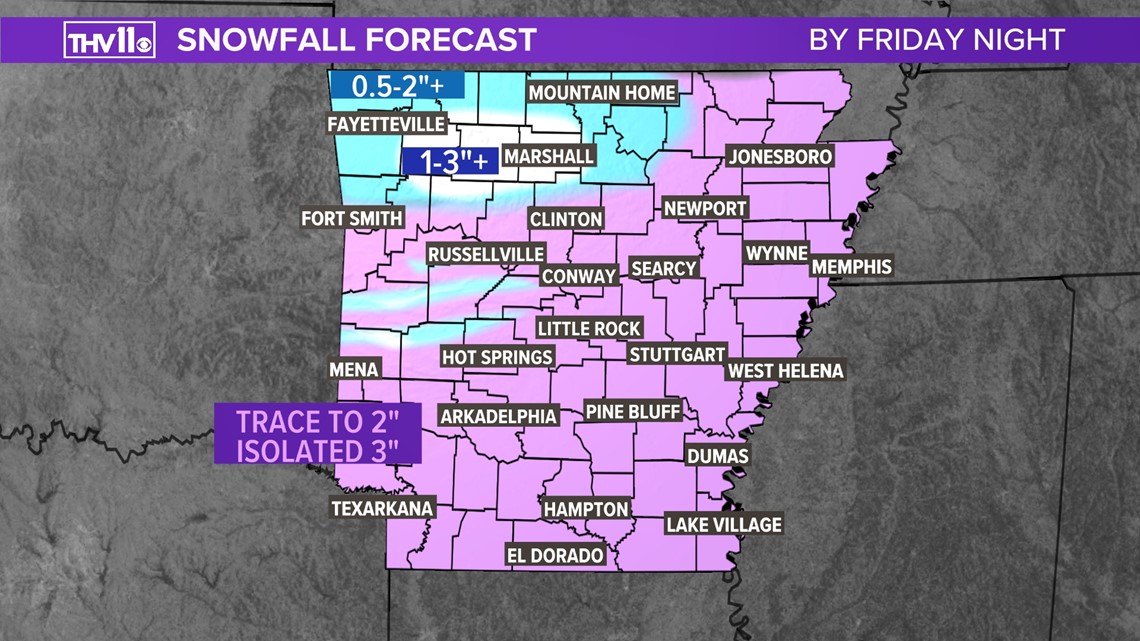
The highest snow amounts are expected in the higher terrain of the Ozarks and Ouachitas since the cold air will be in these locations longer. On Rich Mountain and Mount Magazine snowfall accumulations may exceed 3 or 4".
Impacts on roads in central Arkansas look low, but heavy snow rates could make for slick spots on bridges and overpasses. Roads will likely become snow-covered and slick in the higher terrain of the Ozarks and Ouachitas.
The opportunity for the highest chance of snow in central Arkansas appears to be in the mid-afternoon and ending before Midnight Saturday.

Behind this fast-moving system skies will clear out and temperatures will drop into the mid-20s by sunrise on Saturday.
But that’s only half the story because the wind will make it feel like the single digits to teens waking up Saturday morning.
Highs on Saturday with plenty of sunshine will climb into the low to mid-40s.
This is a brief cold snap as the winds switch to the south and southwest on Sunday, ushering in warmer and more comfortable conditions going into the new week.
By Wednesday the mercury is expected to soar back over 70 degrees!
Stay tuned to THV11 for the latest on what could be the final snow accumulation of the season for central Arkansas.