
LITTLE ROCK, Ark. (KTHV) - Gordon made landfall as a Tropical Storm late Tuesday night.
The National Hurricane Center has Gordon’s path cutting through Arkansas.
While there is still some uncertainty, here is a timeline for Gordon’s impacts on the Natural State.
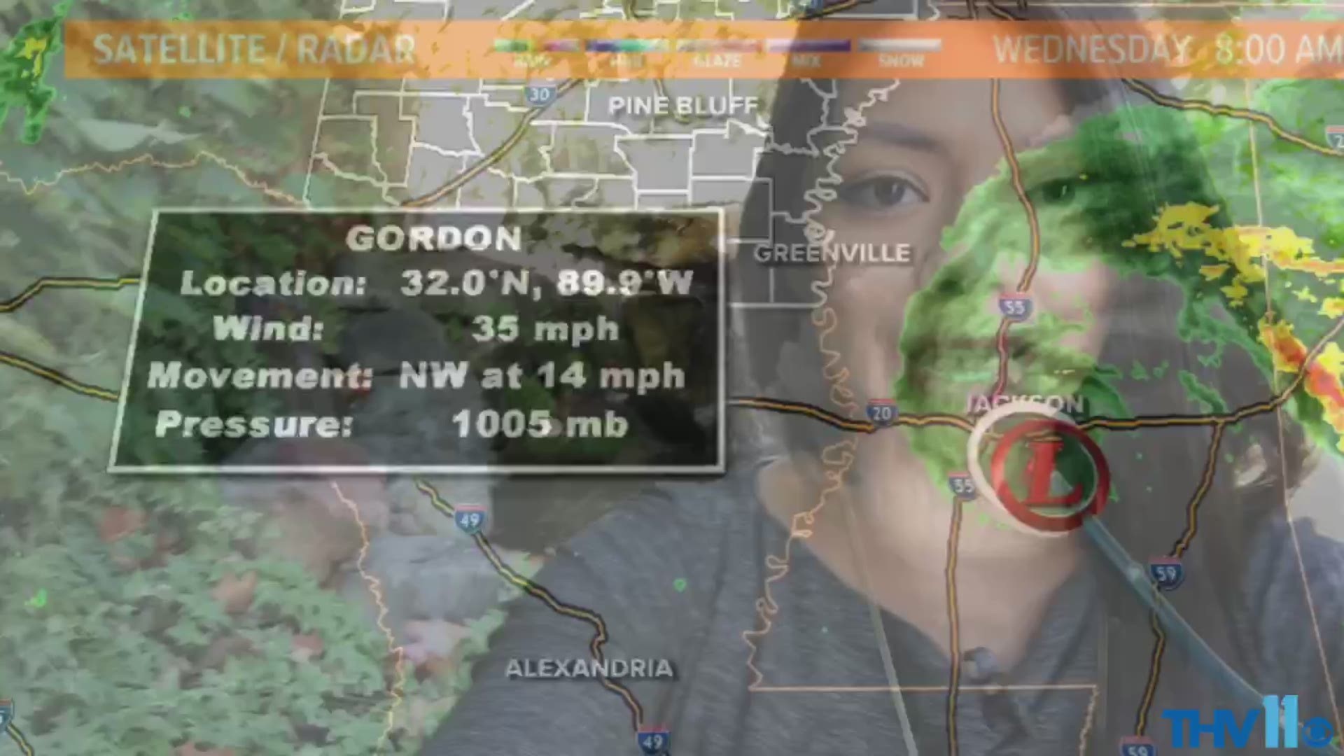
Wednesday morning: Gordon has downgraded to Tropical Depression Gordon. This means max sustained winds have dropped below 40 miles per hour. Gordon continues to move NW through Mississippi. Cloud cover starts to move into our eastern counties.
Wednesday afternoon: The center of Gordon, now a tropical depression, will be approaching southeast Arkansas. This is the time we will be looking for heavy rainfall due to outer bands along our eastern counties. Gusty winds at times.
Thursday morning: The remnants of Gordon will still be in south Arkansas and moving northwest across the southern half of the state. This will be a time for monitoring heavy rainfall. Some storms in the bands of the tropical cyclone may be on the strong side. Western Arkansas will begin to see some rain around this time frame.
Thursday afternoon: Remnants of Gordon will be lingering in central/south central Arkansas. Rain will be more widespread across the state. We should be monitoring for heavy, slow-moving rainfall.
Friday morning: The low or what is left of Gordon will be moving into western Arkansas. Widespread rain continues for the state. At this point, the soil is saturated, so any additional rainfall could cause flooding.
Friday afternoon: Remnants of Gordon move north toward and into Missouri. Rain does not completely end but will become more scattered.
Weekend: Rain chances stick around as tropical moisture interacts with a front moving in from the plains. No severe weather its at the moment. There will be a sharp difference across the state with rainfall totals. Areas in the southern half of the state could see 4” to 6 inches of rainfall between now and the end of the weekend.
The reason Gordon will move the way it does is because of the surface and upper-level high pressure. If the pressure moves, it could change the path of Gordon.
As always, stick with us for the latest info!
Stay connected with THV11 for the latest news, sports, and weather. Download the THV11 News app now.
RELATED HEADLINES: