

LITTLE ROCK, Ark. (KTHV) - Friday starts off warm and humid.
With the spring-like conditions, storms will be possible later Friday, Nov. 30.
Some will be on the strong to severe side.
What:
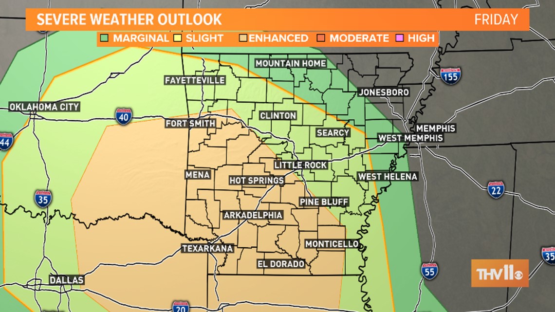

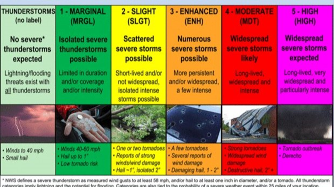
The Storm Prediction Center has put portions of Arkansas under an “Enhanced Risk” for severe weather. The closer to this enhanced region you are, the more likely you are to encounter a strong to a severe storm. The higher the category, the more numerous severe storms there will likely be. Severe means winds of 58 mph or higher, quarter size hail, and/or a tornado.

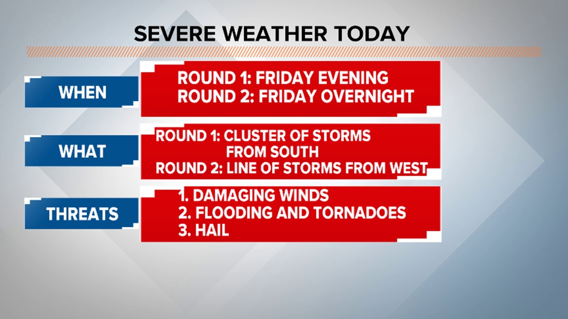
There will be two “rounds” of likely severe weather.
Round One develops in northern Louisiana and moves north through Arkansas late this afternoon and through the evening. With this round, all modes of severe weather will be possible. The big one is the potential for damaging wind. The secondary threats are flooding and the potential for tornado development. Hail cannot be ruled out either. The severity of the storms will depend on daytime heating, or how warm the surface gets.
Round Two develops to our west along a cold front. This set up will look more like a line of storms moving from west to east. This moves into our western counties just after midnight and will make it to our eastern border by sunrise. With this line, daytime heating is not a factor. There will be enough influence from a nearby low for severe storm potential. The only limitation will be how much the atmosphere is “worked over” from previous storms. The main concern here will be the potential for strong winds ahead of the line, as well as the potential for brief spin-ups within and ahead of the line. Heavy rain moving over an area that has already seen rain can also cause the potential for flooding.
Saturday morning then looks windy! This will help bring in dry air into the region.
SEVERE STORMS TIMELINE :
We will see cloud cover and areas of scattered light showers in the morning and early afternoon. It will be warm and humid.
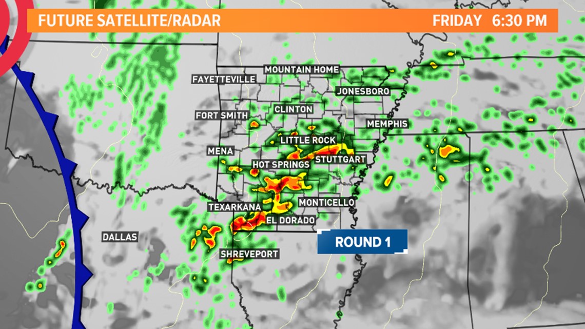
Round one develops in northern Louisiana around 3 - 4 p.m. and moves north into Arkansas through the evening hours reaching central Arkansas around 5 - 6 p.m.
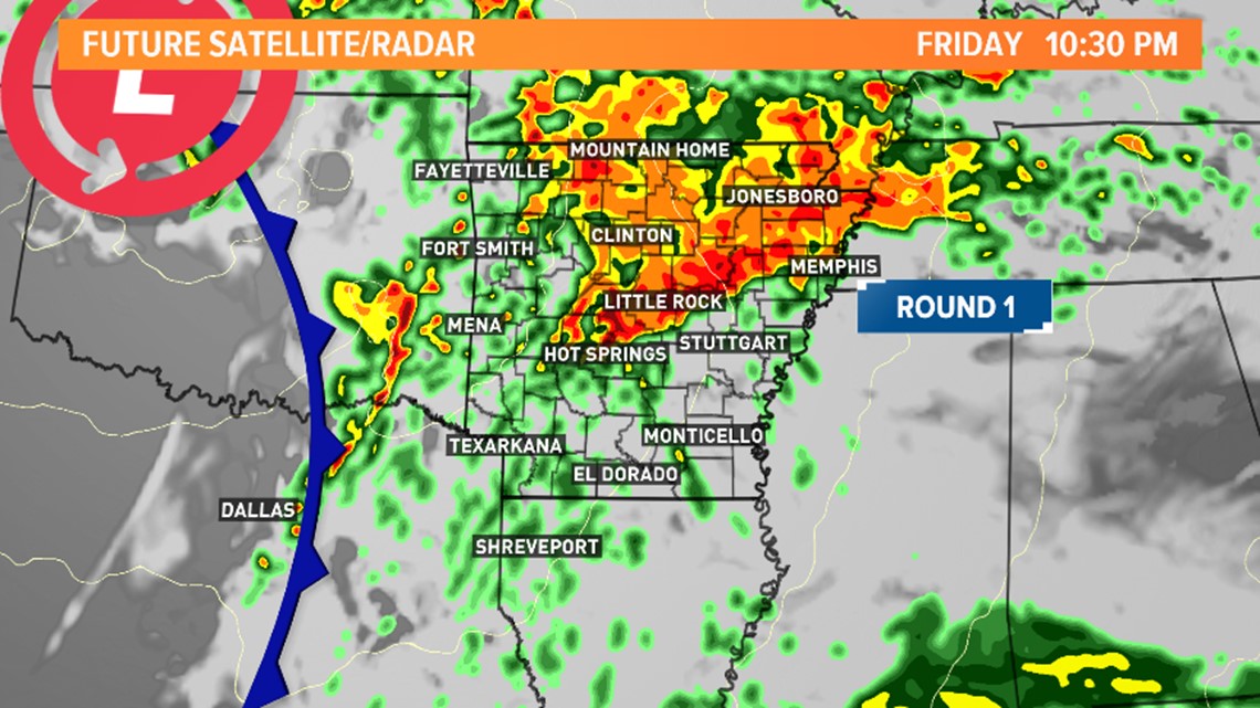
Round one becomes more widespread before midnight as it moves north.
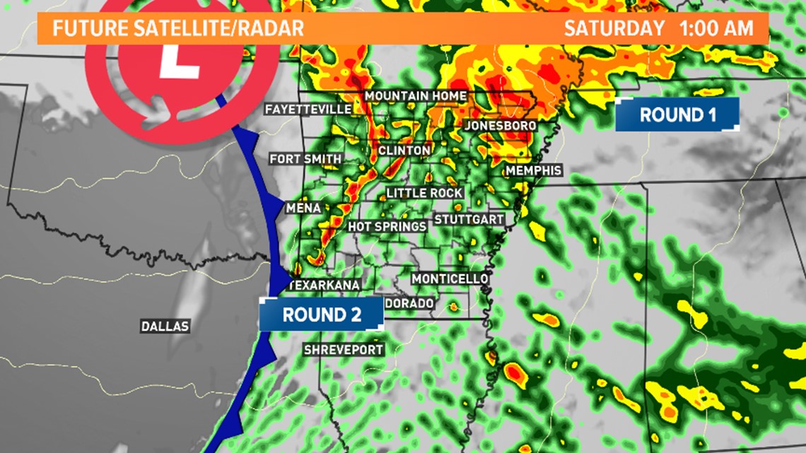
Round 2 reaches western Arkansas just after midnight.
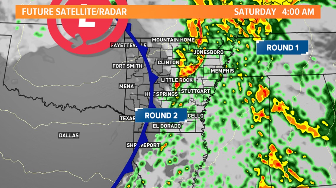
Round 2 line of storms reaches Central Arkansas in the 2 a.m. – 4 a.m. time frame.

The line of storms leaves the state by sunrise on Saturday.
Windy weather to follow Saturday morning.

Stay connected with THV11 for the latest news, sports, and weather. Download the THV11 News app now.
Have an idea for a story? Send news tips to news@thv11.com, and visit us on Facebook, Twitter, Instagram and YouTube!