THV11 and our meteorologists are dedicated to keeping Arkansans safe. That's why we're doing all that we can to keep you informed about the possibility for some rough storms ahead. The threat for severe weather across Arkansas will increase through the afternoon on Monday, November 5.
WHY
There are a couple of chances to see rain. The first is just a general region of scattered showers seen before noon. This is because of a warm front moving north across the state through the morning.
No severe weather is expected with this front. The warm front is bringing in warm, moist air back to Arkansas. More clouds will be seen with the movement of this front. This will last through the early afternoon.
The second chance for rain comes as a cold front approaches from the northwest and pushes west to east across the state this afternoon. This front will interact with the moist, warm air that the warm front put in place.
WHEN/WHAT
The more east the front pushes, the more well developed a squall line becomes. This means a line of showers and thunderstorms becomes well defined.
3 p.m. - Central Arkansas sees the light rain early in the day. The threat becomes bigger around 3-4 pm when a squall lines becomes better developed. The threat here then moves to the leading edge of the line of showers and thunderstorms. In this case, the eastern side of the line. This is where we can find strong wind gusts. Heavy rain and lightning will also be seen.
5:30 p.m. - The intensity of rain increases as the line pushes east/southeast. As the rain moves east, it moves into a more unstable atmosphere. This means that the threat for seeing higher wind gusts, heavier rain, lightning, and the potential for a spin up is heightened.
7 p.m. - The threat for SE Arkansas is still there. The risks are the same as 5:30, but the line has moved slightly more east.
9 p.m. - The risk of severe weather moves out of the state and continues to impact Tennessee, Mississippi, and Alabama overnight.
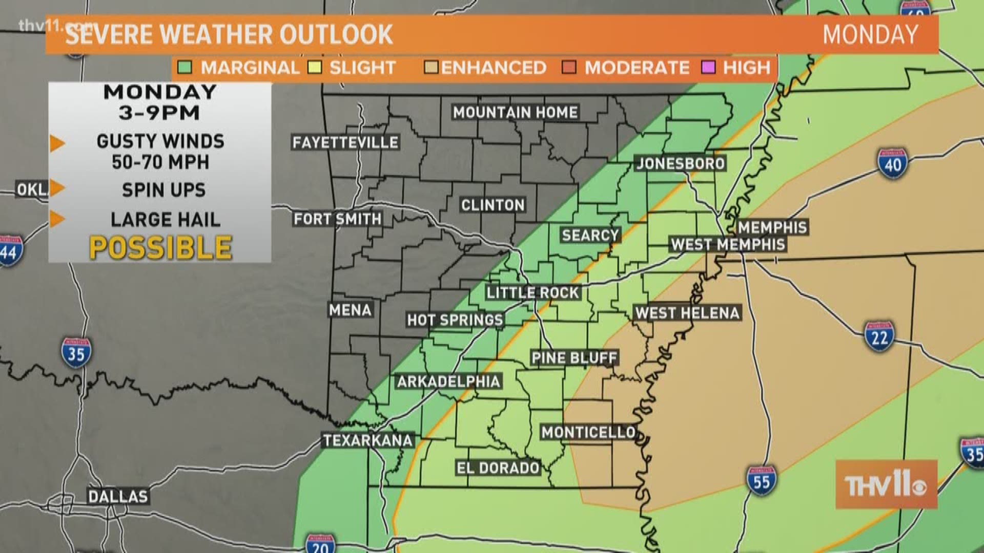
The image above shows the likelihood of seeing severe storms in general. A severe storm means 60+ mph winds, quarter size (or larger) hail, and/or a tornado signature. This shows that the bullseye is over east Arkansas, Tennessee, Mississippi, and Alabama. The more east/southeast you are, the more likely you are to see a strong to a severe storm.


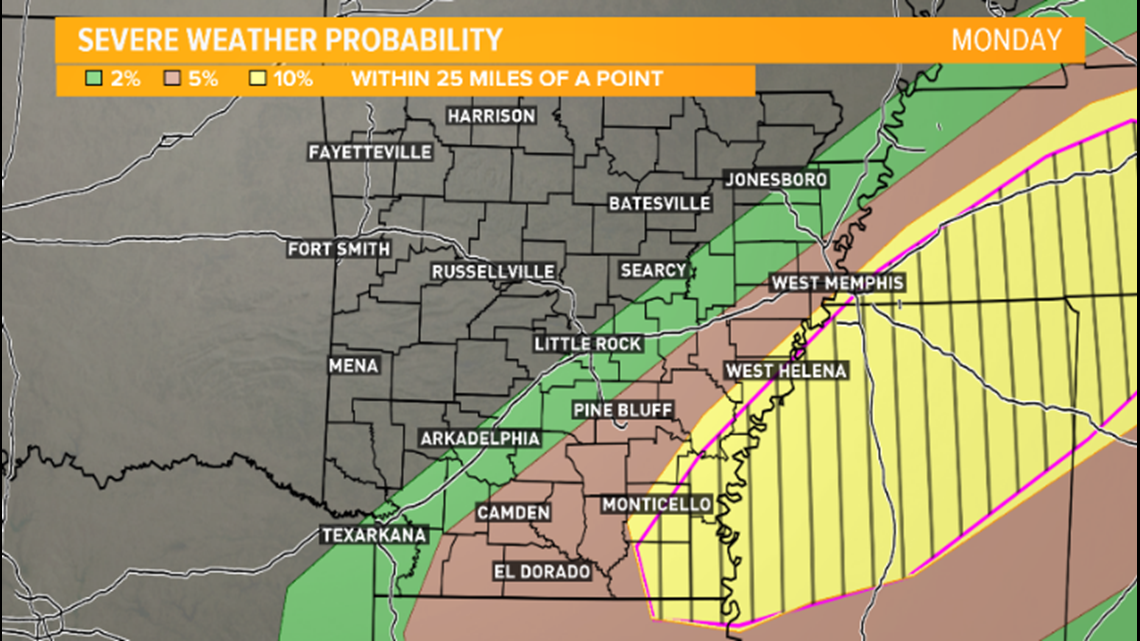
The image above shows the probability of seeing a tornado within 25 miles of any given location. The yellow area now extends into far SE Arkansas and that represents a 10% chance. This is just saying that the chance to see a spin up is low, but it is there. Chances for Central Arkansas are even lower. There are higher chances of this being a strong wind event.
Be sure to stay weather aware and have a plan in place! Keep mobile devices charged and nearby.
Stay connected with THV11 for the latest news, sports, and weather. Download the THV11 News app now.
Have an idea for a story? Send news tips to news@thv11.com, and visit us on Facebook, Twitter, Instagram and YouTube!

