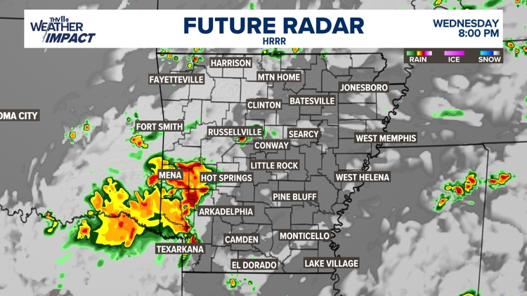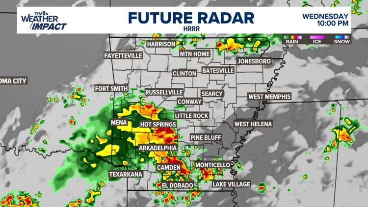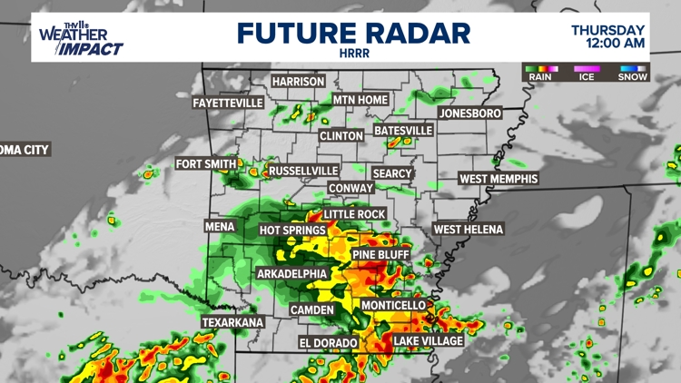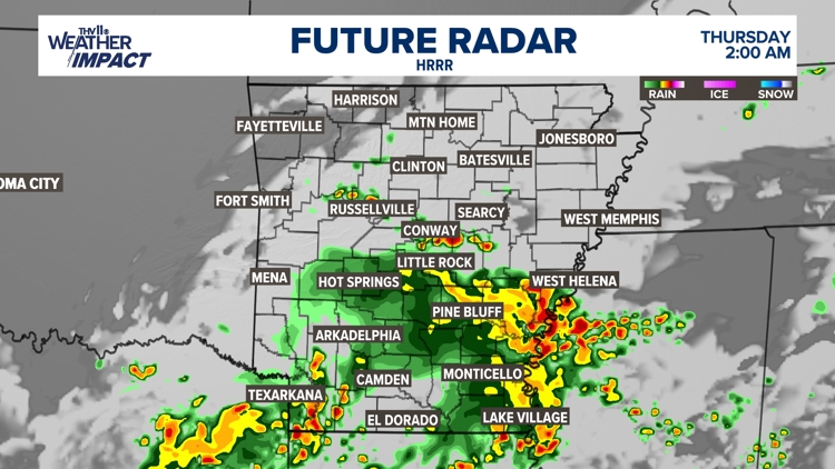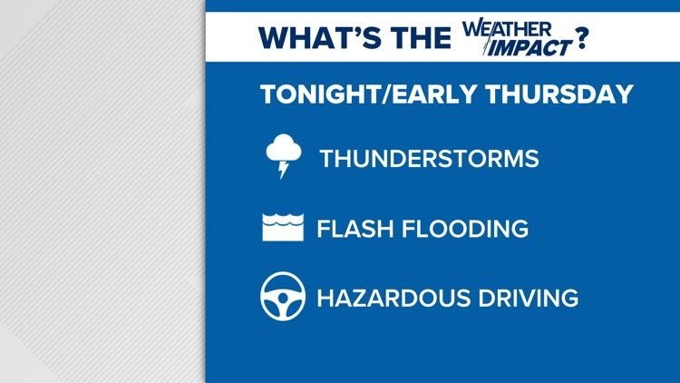


LITTLE ROCK, Ark. — Thunderstorms are expected once again tonight to impact portions of central and southern Arkansas.
An area of low pressure in the upper levels of the atmosphere, along with a cold front, is expected to slowly move across Arkansas tonight and Thursday.
Below you will find all the information you need to know about the incoming rain:
When will the storm arrive
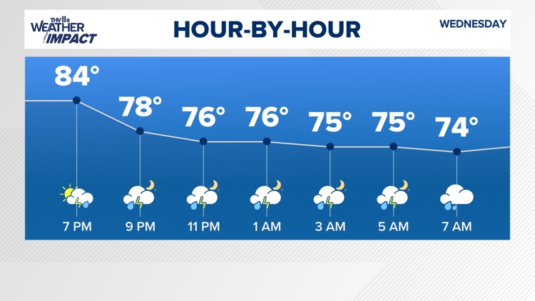
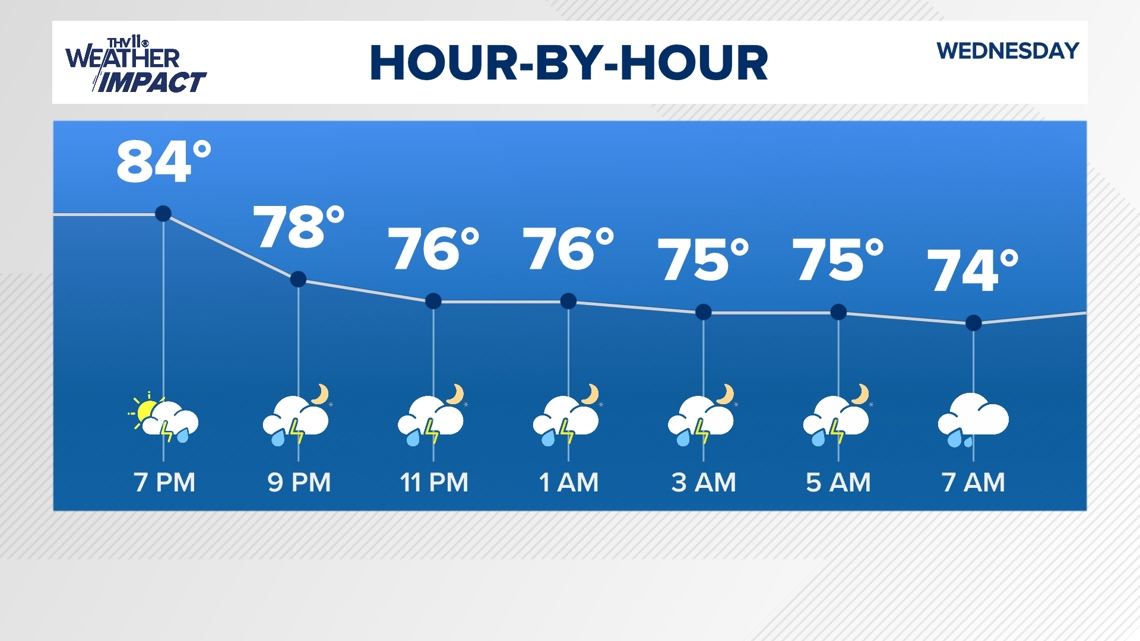
The latest timing places thunderstorms in western Arkansas during the late afternoon and evening hours.
They will increase in coverage, and heavy rain that could lead to Flash Flooding is possible.
The rain is expected to move into the state around 8 p.m. on Wednesday and stay until early Thursday morning.

How it impacts Arkansas
With slow-moving thunderstorms and heavy rain, localized street flooding and flooding along creeks and streams are possible.
If you are camping, choose a campsite away from creeks or other low-lying areas prone to flooding.
Need to stay aware
Stay weather-aware tonight and through the early morning hours on Thursday of the potential for flash flooding. Remember, "Turn around, and don’t drown.” Stay informed of which roadways will likely flood and find an alternative route to avoid them. The National Weather Service encourages everyone who might experience a flood to create a communications plan, so your family knows how to connect during an emergency.
If you are in flood waters, it is best to find higher ground and follow evacuation orders. If time allows, the National Weather Service recommends disconnecting utilities and appliances before evacuating.