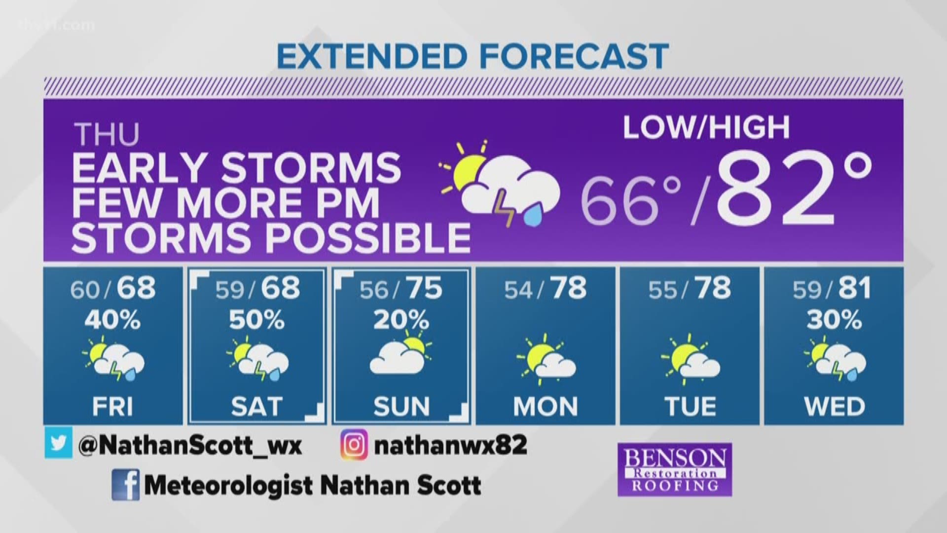
The THV11 Weather Team will be busy through Thursday as three rounds of storms look likely to move across the state. Very heavy rain is possible within a short period of time and could lead to significant flash flooding of small creeks, low lying areas and poor drainage areas.
The National Weather Service has posted a Flash Flood Watch through Thursday morning for most of central Arkansas.
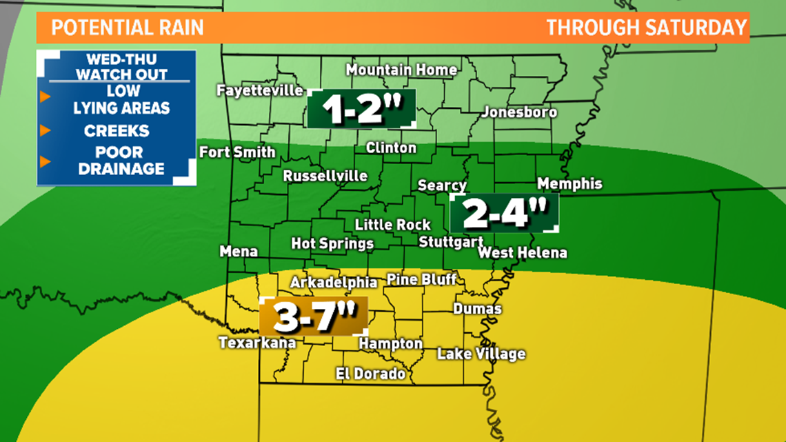
Most of central AR could see 2 to 4” of rain in the next couple of days. Higher amounts expected in southern Arkansas. Some localized areas in southern Arkansas could get 7 or 8” of rain from this event.
The map below shows the rainfall totals expected through Saturday.

Remember to never attempt to drive through a flooded road. You don’t know how deep it is and the road may be damaged or washed away.
A foot of water can float many vehicles, not to mention why take a chance of ruining your vehicle.
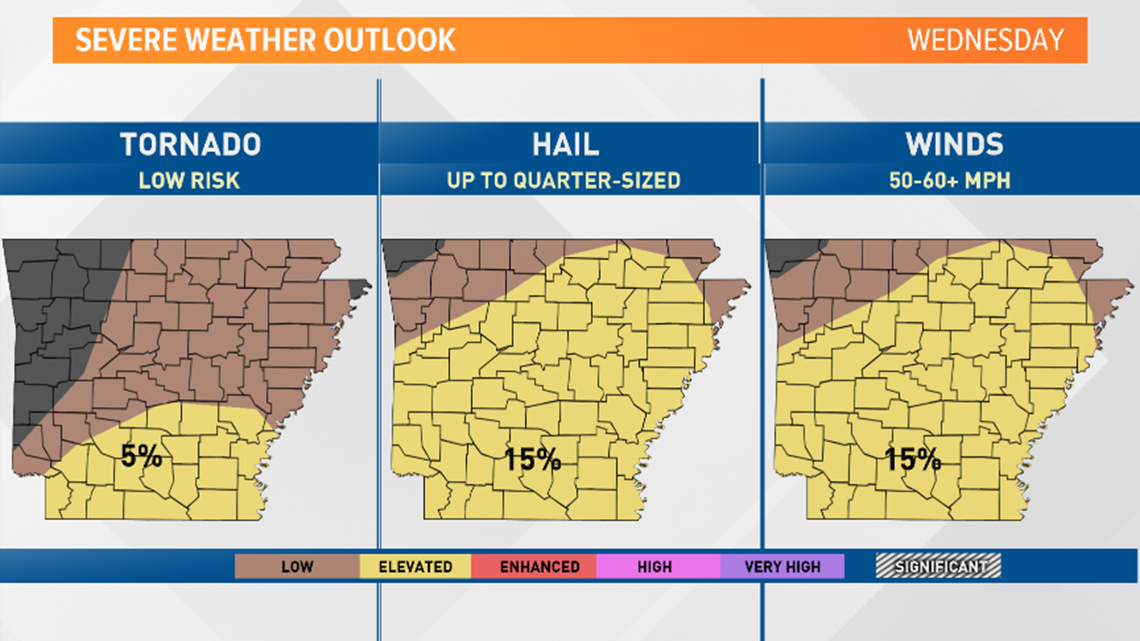
Along with the threat of heavy rain is the chance of strong to severe storms. The main threats will be damaging straight-line winds and brief weak spin tornadoes embedded within the line. Except for southern areas of the state where the threat is higher. The Storm Prediction Center has removed the “Enhanced Risk” for severe weather Wednesday. However, high flood threat and strong storms with damaging winds are still expected.

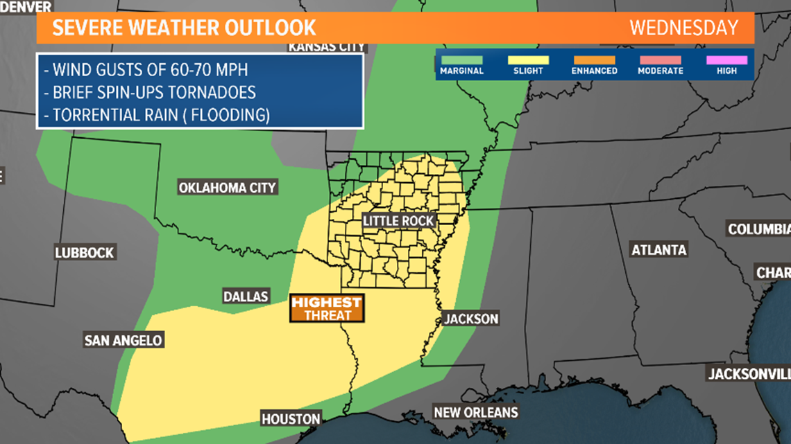

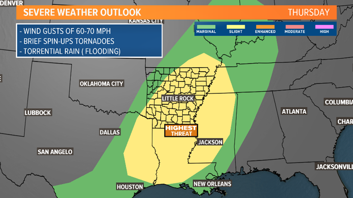
TIMELINE: Here is what to expect

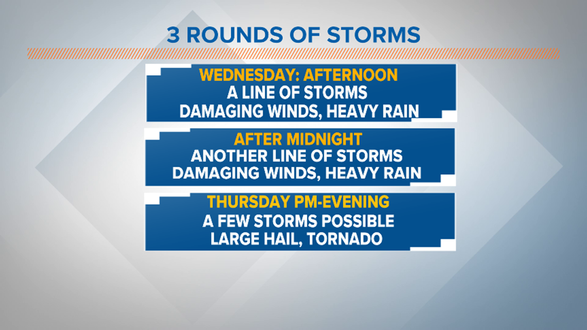
ROUND 1:
A line of strong to severe storms with heavy rain will approach west areas of the state between 8 a.m. to 1 p.m. This line will arrive in most of central Arkansas between 11 a.m. at the earliest to 3 p.m. at the latest. Areas east can expect the storms to arrive in the afternoon. Severe weather threat over by 8 p.m. for the state.
Main threats along the line are damaging straight-line winds, and brief tornadoes. Hail is also possible.

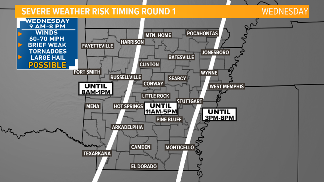
ROUND 2:
Storms will fire up again after midnight Wednesday night into early Thursday morning. This line will also have the potential to produce very heavy rain and damaging winds. There is a small threat for tornadoes, and hail. Thursday morning commute could be messy. Storms should be done by mid-morning.


ROUND 3:
A cold front will enter the state. If some cloud cover breaks Thursday afternoon, the atmosphere could recover energy and new storms could fire up ahead of the cold front.
The main threats will be large hail and tornadoes with a few storms, but this threat is conditional.

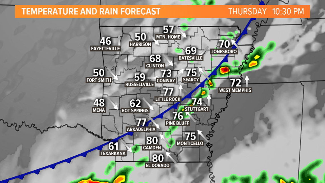
TORNADO RISK:
The threat for tornadoes is low, but it is not zero. The map below shows the higher risk to see the spin ups will be along southern Arkansas. Bigger chances for hail and strong winds. Make sure you have a way of getting warnings and watches especially when you are sleeping. The THV11 Weather Team will be here around the clock until the threat passes keeping you updated.
Have your shoes in a place where you can find them easily if needed, know where your pets are and can be quickly taken to safety, and any important documents may need to stored in a closet or a safer location if possible.

